Tag Archive

tactile maps

About TMAP

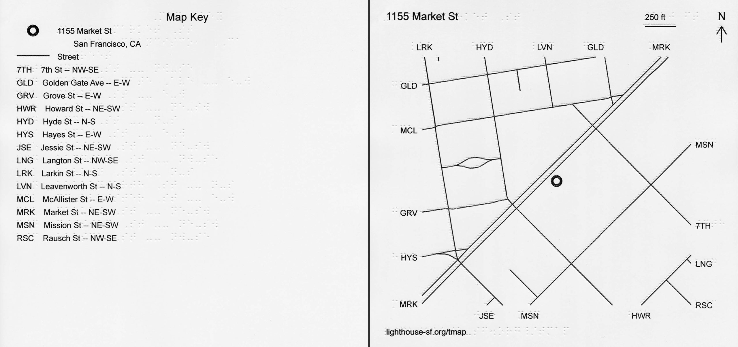
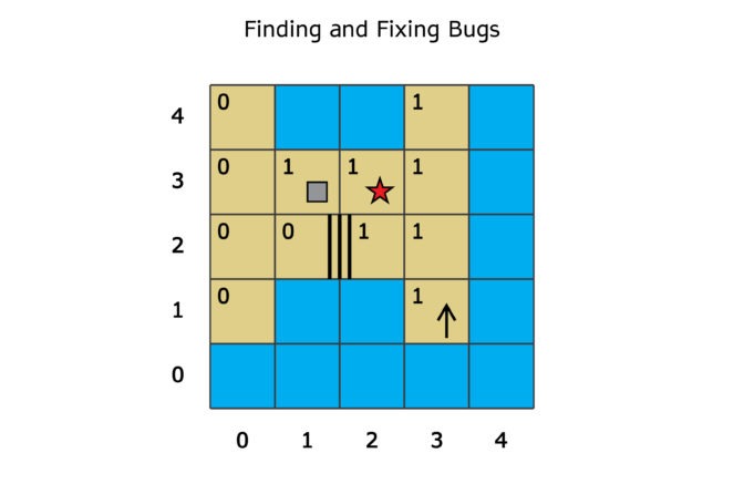
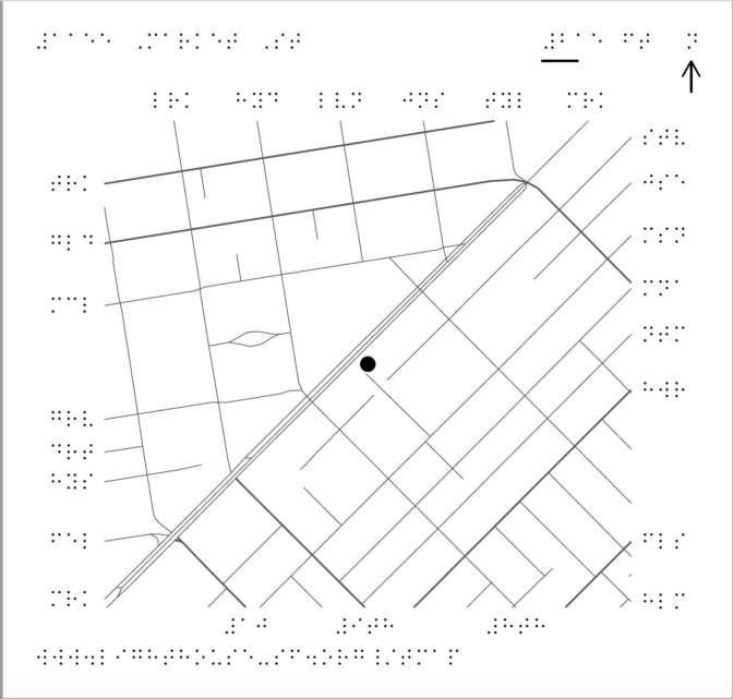
How can someone without eyesight learn a city block or navigate a new neighborhood? In 2018, the LightHouse of the Blind and Visually Impaired – SF introduced TMAP: Tactile Maps Automated Production, offering on-demand tactile street maps.

Covering an area of several blocks surrounding a given address, TMAP uses both braille and large print to identify streets, represented by crisp, raised lines that can be easily followed with the fingertips.

TMAP is a collaboration of the LightHouse for the Blind and Visually Impaired, and the Smith-Kettlewell Eye Research Institute.

Side by side key and tactile map of 1155 Market Street showing braille and print text, tactile and ink street lines.
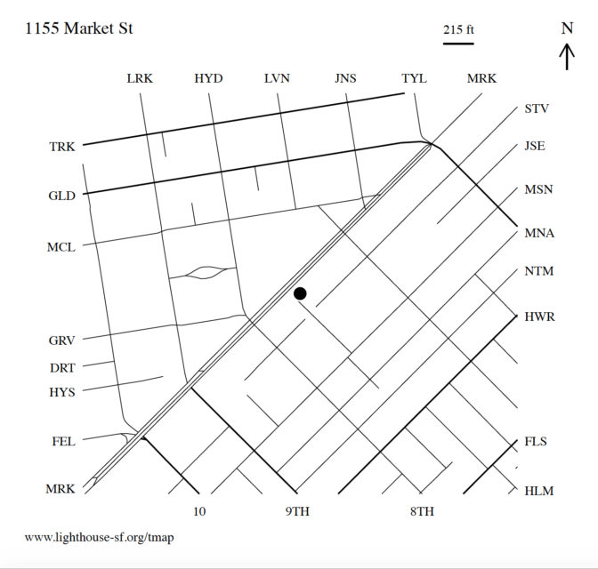
TMAP of the LightHouse Building location in San Francisco, CA.

Order a map for $26.25

To order a map, call our product specialists at 1-888-400-8933 or or visit adaptations.org and specify the street address of the map you’re interested in receiving. Within two business days we’ll ship you your map.

What’s in the package?

  • You will receive two maps of the same address, a zoomed-out overview map, and a zoomed-in detail map showing streets, paths, and buildings, if the data is available
  • A tactile map key
  • An introductory page (download intro page)
  • All materials are printed on 11” X 11.5” sheets of embossed paper and include ink / large print labels in addition to braille

Learn more about the MAD Lab where these maps are produced.

Contact

Recent Presentations: At Home With APH: TMAP – Building Environmental Literacy at a DistanceMobility Matters 2020 Slides, Mobility Matters 2020 Video Presentation

Related Blog Posts: Maps, at your Fingertips, New local tactile maps at Adaptations

Love maps? Sign up for our newsletter!


Reading Tactile Maps

Lesson Plans

Learning to read a tactile map can be a challenge. LightHouse O&M instructor Sarah McIntyre has put together two lesson plans to help students get acquainted with TMAPs.

Download Sarah’s Lesson Plans: Reading a TMAP and Using a TMAP While Exploring.

Other Resources

Teaching Tactile Graphics (Lucia Hasty for Perkins)

Related Posts: Putting the Mobile in Mobility

Related Pages: Frequently Asked Questions, How to Use TMAP to Make Maps, Reading Tactile Maps, Learn more about TMAP

New local tactile maps at Adaptations

New local tactile maps at Adaptations

Photo: Sarika Dagar

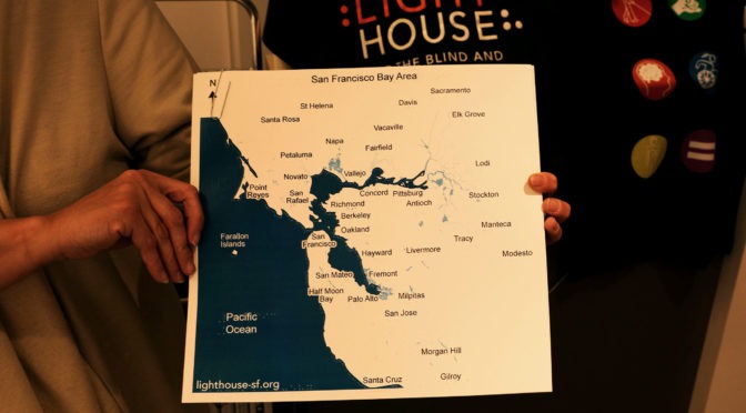
Our Mad Lab designers have been hard at work producing a set of new maps of our region. Never before have curious blind travelers had these tactile maps, and they can be acquired immediately from LightHouse’s Adaptations Store.

Here is a list of the available maps:

• San Francisco Bay Area Cities: Ever wonder where the heck Piedmont actually is? This map shows the major cities in the greater San Francisco Bay Area. $15

• San Francisco Bay Area Counties: This map shows the counties in the greater San Francisco Bay Area. Now you can see, for example, why Contra Costa County is actually north of Albany. $15

• San Francisco Bay Area Highways: You’ve heard of highway 13, or 237, or 92. Now you can see exactly where they are and how they connect. This map shows the main highways of the greater San Francisco Bay Area. $20

• San Francisco Neighborhoods: Just where does the Western Addition end and the Richmond District begin? Now you can find out. This map shows the neighborhoods in the city of San Francisco. $15

• California: Sacramento is actually more north than people commonly think. This map shows the state of California and its major cities. $20

Each map comes with braille and large print labels and is available for pickup. Get yours today by visiting our Adaptations store on the 10th floor at LightHouse Headquarters, 1155 Market Street in San Francisco. Or for extra convenience, just phone in your order and we’ll mail it to you. For more information call Adaptations at 1-888-400-8933 or email our store staff at adaptations@lighthouse-sf.org.

Blind Students: Learn to Code with Swift Playgrounds Tactile Puzzle Worlds

Blind Students: Learn to Code with Swift Playgrounds Tactile Puzzle Worlds

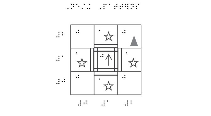
Today San Francisco’s LightHouse for the Blind announced a collaboration with Apple to make learning to code more accessible to students who are blind or have low vision. LightHouse’s Media and Accessible Design Lab (MAD Lab) has created Swift Playgrounds Tactile Puzzle Worlds compatible with Swift Playgrounds, a free, fun and accessible iPad app aimed at teaching students to code. The MAD Lab has designed 47 tactile layouts corresponding with the 3D puzzle worlds found in Learn to Code 1. 

These tactile graphics enable students to better orient and navigate their way through Swift Playgrounds by touch. The materials supplement the accessible in-app coding experience, and include Unified English Braille (UEB) and large print text, with high-contrast and embossed tactile graphics in order to be universally accessible. The collaboration is all part of Apple’s Everyone Can Code program, an accessible curricula aimed at bringing coding into more classrooms.

“I’m not going to be one of those people who’s being told ‘No, you can’t do this because you’re blind,’” says Darren, who was an early blind user of Swift Playgrounds.

Darren, a senior at Texas School for the Blind in Austin, learned about Swift Playgrounds at Coding Club, an evening program facilitated by his school. TSBVI was one of the first schools to begin offering the Apple coding program to students. It was a fortunate discovery for him — especially in a world that often assumes a blind person can’t learn to code.

Darren first pursued his dream of learning to code at a public high school, but the online coding module used in his intro-level class was not accessible. As a result, the school offered him a cumbersome accommodation: the teacher assigned a fellow student to read Darren the lines of code and type his responses. For Darren this was a considerable barrier: not only did he not get hands-on experience, but he had to work at someone else’s pace.

“I think the teacher knew it was frustrating,” Darren says, “but he wasn’t entirely sure how else to make it accessible.”

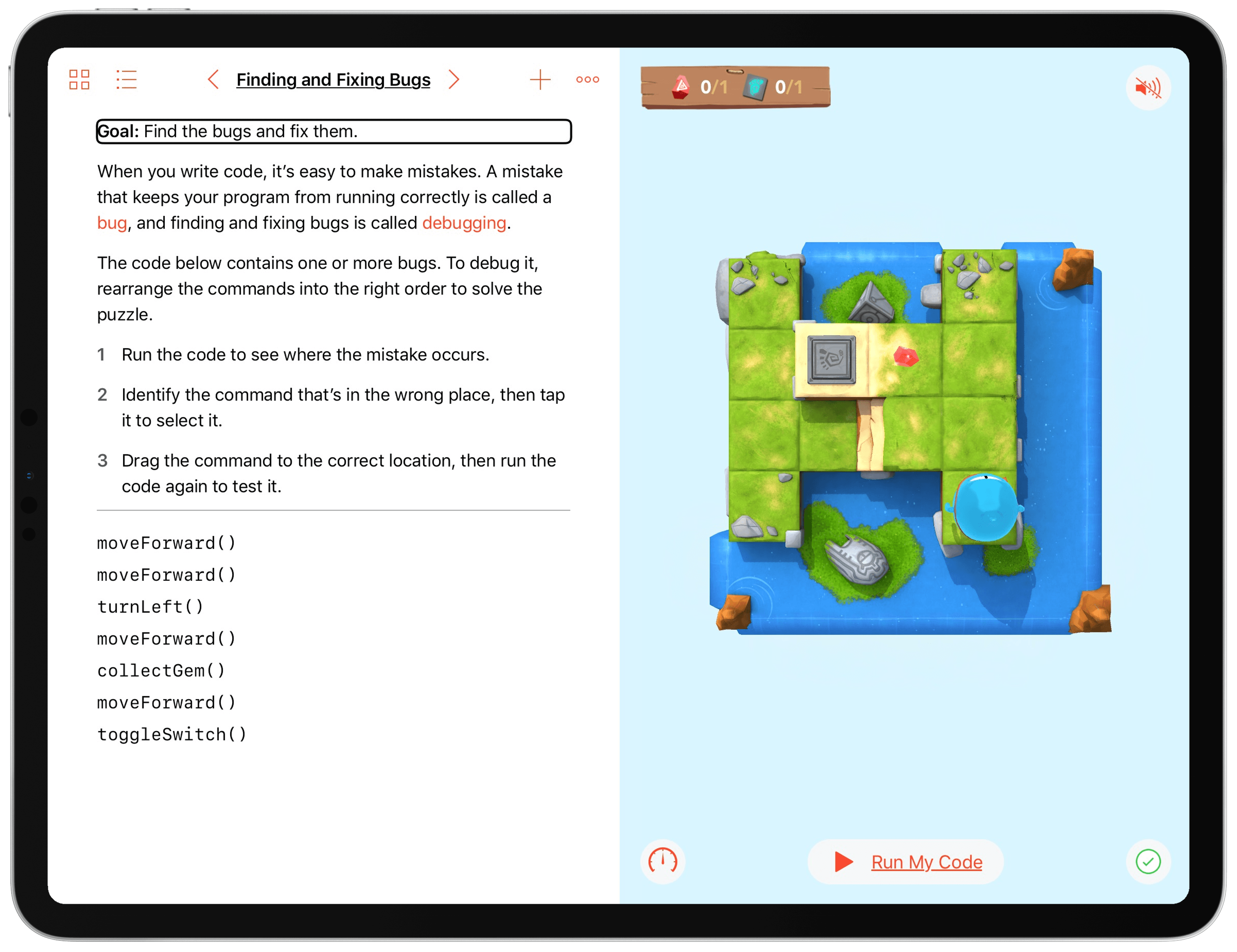
When Darren first heard that the Swift Playgrounds app was accessible, he downloaded it onto a rented TSB iPad, eager to dig into a new world of coding. But as his new coding class started and he began to work his way through the “puzzle worlds” that make up the game’s levels, he felt he would benefit from also having tactile feedback.

iPad showing Swift Playgrounds app and accessible features.

“At first it was confusing because I didn’t know how the world looked,” he says, without a hint of irony. Thanks to Apple’s commitment to accessibility, Darren could use Swift Playgrounds with VoiceOver, Apple’s built-in screen reader, but he needed a way to explore and experiment in the 3D puzzle world – collecting gems, toggling switches – and in order to do that, he needed a mental map of the physical layout.

Enter the MAD Lab

Swift Playgrounds Tactile Graphic Visual Design

Meanwhile Apple was working on a solution – with help from the LightHouse’s Media and Accessible Design Lab.

Building off years of experience creating tactile maps of cities, universities and cultural landmarks for blind and low vision explorers, the MAD Lab is proud to present a new accessible media experience by designing a tactile experience that corresponds to a dynamic 3D puzzle world. Mapping the visual layouts of each puzzle world and enhancing them with cartographical elements to optimize for comprehension, the LightHouse is proud to partner with Apple to further the blindness community’s tech literacy, around the world.

Putting the tactile worlds to good use

Once the Texas School staff got their hands on the guides, everything changed for Darren. “We were creating graphics,” his teacher, Susan O’Brien says. “We had 3D printed some of the switches, the toggles, the portals, but then when we saw your maps, we were like ‘oh my gosh, this is so much better than what we’ve been doing.’”

Today, Darren uses the tactile layouts map to orient himself to the world, then he’ll talk through the commands, then go back onto the iPad and really start to do the coding. “We saw him develop a workflow,’ says O’Brien. “Finding that workflow that’s best just for you – that’s so crucial for everyone, blind or sighted.”

For Darren’s part, he’s now working his way through the game, twice as fast as before. “I’m extremely happy that I don’t have to rely on someone else to get the job done now.”

Downloads for students and educators

Teachers or organizations who have access to braille embossers can download the tactile graphics files to print themselves, or if an embosser is not available, can order beautifully printed, embossed and bound hard copies through the LightHouse’s Adaptations Store.

Swift Playgrounds is a revolutionary iPad app that makes learning programming language Swift interactive and fun. It requires no coding knowledge, so it’s perfect for students just starting out.

Download the Swift Playgrounds app for free app on the App Store

Download Swift Playgrounds Tactile Puzzle Worlds for free via Apple

Don’t have an embosser? Buy full-color or tactile-only editions at the LightHouse’s Adaptations Store (1-888-400-8933).

Behind the Map: Why a GPS pioneer still uses paper

Behind the Map: Why a GPS pioneer still uses paper

In January, LightHouse started offering TMAP — on-demand tactile street maps — for order at our Adaptations Store (1-888-400-8933). We have been hearing some amazing stories about how our maps are being used, so we wanted to share them with our mapping community.

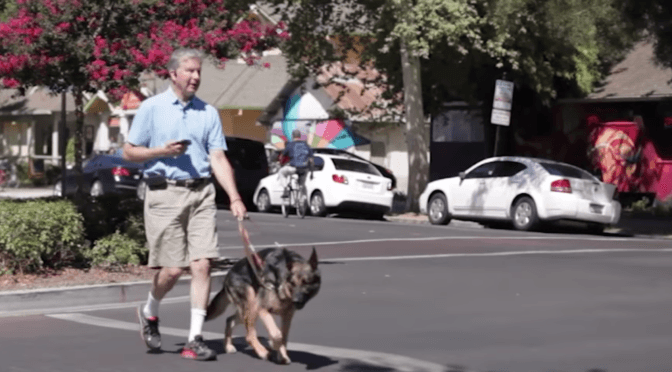
Mike May knows a bit about maps. He founded the company that launched the first accessible GPS, Sendero Group, and since 1999, Mike has introduced the world to a variety of talking map softwares, transforming and shaping the way blind people travel.

But despite his love for technology, if you step into Mike’s home or office, you’ll find the tables adorned with what may seem to be a vestige of the past: paper maps.

“The GPS is great in terms of volume, and numbers of points of interest and streets and all of that, but if you want to have a picturea tactile, geographic way of understanding streetsthen there’s nothing better than a tactile representation,” Mike says.

Mike’s a firm believer that hard-copy maps still meet a crucial need for non-visual learners that is currently not being met elsewhere.

The current iteration of TMAP differs from when he first encountered the beta version years ago in form and in scope, but he said that its application serves a critical, universal need: to orient by communicating a physical, material sense of space.

“The value of tactile maps is something that’s been around forever,” he says. “The ability to deliver those maps to people nationwide in a cost-effective manner is really the key.”

Mike has been blind since age 3, and has been involved with the LightHouse since age 7, when he went to camp at Enchanted Hills. In the 1980s, he was on the LightHouse board, and today lives in Wichita, Kansas where he serves as executive director of the Workforce Innovation Center at Envision.

When Mike moved to Wichita from the Bay Area earlier this year, he turned to the LightHouse’s made-to-order TMAPs.

“I needed to learn at least two things: one is my work location, and my home location,” he says. “I called up and I ordered maps for both spots, got a nice clean package, and now I have those available at my house. And I have the work ones available not only for me…we have lots of blind people, just like the LightHouse, that can take advantage of it here, so those maps sit in our reception area for anybody to browse.”

Mike said that he thinks the future of TMAP could include tech integration with the current physical form. As it exists now, he said that TMAP is both a unique and critical tool. “I think it’s a very undiscovered capability, and I applaud the LightHouse for making it available,” he says.

Get your TMAP today

To order a map, call our product specialists at 1-888-400-8933 and specify the street address of the map you’re interested in receiving. Within two business days we’ll ship you your map, or make it available for pick up at the Adaptations Store (1155 Market St., 10th Floor, San Francisco, CA).

What’s in the package?

  • You will receive 3 map versions printed at simple, moderate and dense map scale ratios
  • A tactile map key
  • An introductory page
  • All materials are printed on 11” X 11.5” sheets of embossed paper and include ink / large print labels in addition to braille

Learn more about the MAD Lab where these maps are produced.

Love Maps? Sign up for our new ‘Map Love’ newsletter

* indicates required


Behind the Map: A midwesterner meets Market Street

In January, LightHouse started offering TMAP — on-demand tactile street maps — for order at our Adaptations Store (1-888-400-8933). We have been hearing some amazing stories about how our maps are being used, so we wanted to share them with our mapping community. Order yours today by calling 1-888-400-8933.

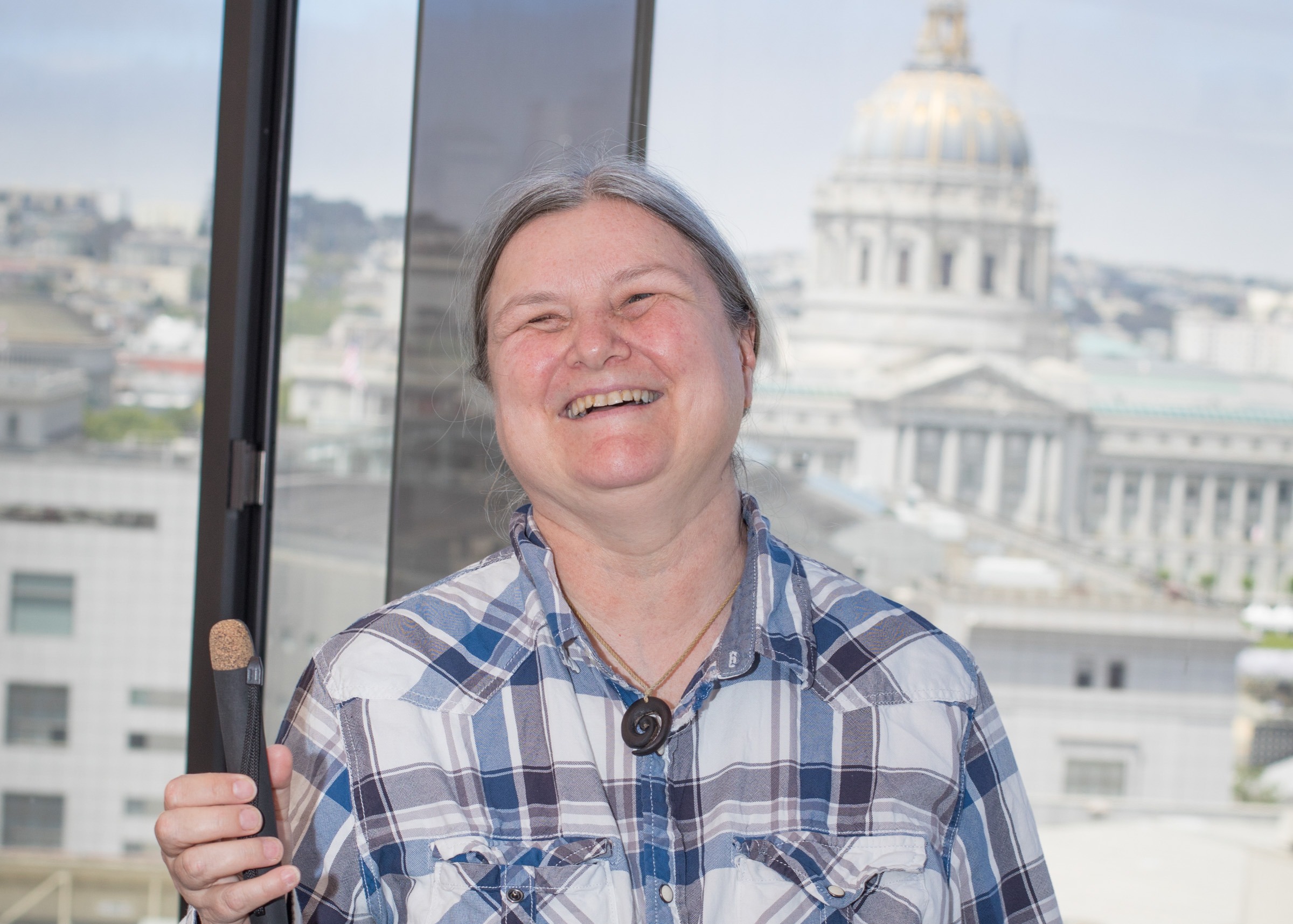
When Sheri Wells-Jensen was a child, she got one book per week. That was how it worked, for a blind kid – a braille reader – who relied on braille lending libraries. Each week, Sheri would bound out of her front door, crashing through her front yard and into the mailman’s truck, to get her hands on one new book. Now a linguistics professor at Bowling Green State University, access to language and information has become a passion of Sheri’s, as well as other cool things like aliens and ukuleles.

A portrait shot of Sheri Wells-Jensen.She also loves exploring cities. Depending on how you see it, Market Street in San Francisco can feel like a boulevard of first-world efficiency or a medieval circus. At times, it feels like both at once. This wild, eclectic fusion can be intimidating for some, but this crazy hubbub is what Sheri loves most about visiting the city by the bay. On a recent trip, we had the pleasure of printing out her first-ever TMAP.

It was right before she was taking off to catch the bus back to her hotel. The bus stop was a few blocks away and Sheri, her own most cheerful but fierce advocate, exclaimed when we told her we had a tool to help her learn the neighborhood in just a few minutes – and that it was something she could bring with her, should she get lost or just want to explore.

image 1: A TMAP of the neighborhood around 1155 Market Street, marked by large print labelsimage 2: a TMAP of the neighborhood around 1155 Market Street, marked by braille labels

“Having an accurate,accessible,hard copy map to explore saves endless frustration,” Sheri says. “It changes the rules of the game: without the map, I get directions and learn a route, hoping to fill in details later on. With the map, I learn the neighborhood and then decide how I want to get to my destination.”

Holding her TMAP in front of her, pressed against her torso as she inspected the braille labels and learned the many swerving diagonals of the area, it was impossible not to feel the infectious sense of  satisfaction that comes from unlocking so much knowledge with such ease – especially for a kid who grew up on only one book at a time.

As Sheri sees it, maps and tactile aids are a crucial tool for anyone who needs access to information. And when she wants to learn an area, she thinks it’s better than talking. “I basically have two choices,” she explains. “I can sit some poor unsuspecting fellow down and grill him relentlessly about every intersection and every street name (most of which he won’t remember) – or – with a map in my hands, I can transfer the whole picture of the area straight into my head, thereby saving time and preserving my friendships.”

You can listen to Sheri talk about braille love letters and why braille is worth fighting for in a recent episode of The World in Words on PRI, entitled “Will blind people use Braille in the future?”.

Get your TMAP today

To order a map, call our product specialists at 1-888-400-8933 and specify the street address of the map you’re interested in receiving. Within two business days we’ll ship you your map, or make it available for pick up at the Adaptations Store (1155 Market St., 10th Floor, San Francisco, CA). Each TMAP package is $19.99 per address.

What’s in the package?

  • You will receive 3 map versions printed at simple, moderate and dense map scale ratios
  • A tactile map key
  • An introductory page
  • All materials are printed on 11” X 11.5” sheets of embossed paper and include ink / large print labels in addition to braille

Click here to learn more more about TMAP.

Love maps? Sign up for our new ‘Map Love’ newsletter!

* indicates required

Subscribe to our mailing list

* indicates required


Behind the Map: This O&M Instructor uses TMAP to demystify the streets of Vacaville

Behind the Map: This O&M Instructor uses TMAP to demystify the streets of Vacaville

In January, LightHouse started offering TMAP — on-demand tactile street maps — for order at our Adaptations Store (1-888-400-8933). We have been hearing some amazing stories about how our maps are being used, so we wanted to share them with our mapping community.

Sarah McIntyre has fond childhood memories of San Francisco. These trips were all defined by one nostalgic artifact: a giant, foldable street map from AAA. “My mother taught me to read maps,” Sarah says. “She was always the navigator.” And though most families now navigate with digital maps, Sarah fondly remembers the hard copies: well-loved, frayed on the edges, markings revealing every adventure past and future.

Today Sarah is an orientation and mobility instructor at LightHouse, and when she teaches blind students, she stresses this point: navigating by smartphone works until it doesn’t — until you’re out of service, or the environment is so loud that the speech from your phone is too hard to hear. Even with endless technology at our fingertips, there’s no match for a real map.

This is why, when our Media and Accessible Design (MAD) Lab started creating automated tactile maps (TMAPs) this year, Sarah immediately adopted the on-demand maps as a learning tool for her students.

Working out of Solano County, Sarah finds that towns like Vacaville – where car culture reigns supreme – can be hard for pedestrians to picture in the mind.

Map segment depicting a point of interest on a loop with multiple cross-streets

Sarah recently used TMAP to confront just this sort of dilemma with a student living on a street that was a circular loop – but not a perfect circle. Using words to explain the tricky extra turn to lead the student back to her doorstep was proving too difficult. New to America, the student had only been in the United States for three years, and mobility was a challenge. It would be a crucial step forward for her to master her home neighborhood.

Normally, Sarah would have confronted this challenge by taking out her DIY mapping kit: a roll of heavy duty aluminum foil, various hand embossers and loose Wikki Stix, among other odds and ends. But hand-crafting a tactile diagram is a big effort to explain one confusing intersection. With TMAP, Sarah had a touchable diagram of the strange circular block printed immediately.

Another student had Sarah print his first TMAP of the area around Gold’s Gym in downtown Vacaville. As luck would have it, the gym turned out to be smack dab in the middle of downtown, which meant that this map would be a particularly good one; useful for finding more than just the gym.

Sarah and her student headed downtown with the map, starting from the center and getting to know the outlying streets –– turning the map with each turn of the corner to navigate methodically, non-visually, through Vacaville’s old town center.

A map depicting many streets in the downtown grid of Vacaville, centering around 201 Main Street.

For her student, Sarah says, the map was a revelation. “He didn’t know how to read a map visually, let alone non-visually,” she points out. “That’s a huge emotional thing for people, to actually gain a new skill that you thought required eyesight.” Now, she says, he is talking about traveling for work and getting to know new cities with a new level of confidence.

Teaching her students to use the map key has also been a huge boost for their mobility. Not only does each TMAP come with a prominent compass rose, but the key lists the running direction (e.g. North-South or East-West) of each street – all in large print and braille.

“I love braille,” says Sarah. Usually when someone who isn’t blind professes such a thing, they’re not actually familiar with the writing system, or at best, a romantic. But Sarah is serious. “Audio is very linear, and you need the ability to stop moving forward, to control the pace you’re reading at and backtrack fluidly and with braille you have that option. Braille works the same way vision does in that sense.”

Sarah tells her students they don’t need to know braille in order to benefit from the TMAPs, but it’s sure a valuable skill to develop.

Get your TMAP today

To order a map, call our product specialists at 1-888-400-8933 and specify the street address of the map you’re interested in receiving. Within two business days we’ll ship you your map, or make it available for pick up at the Adaptations Store (1155 Market St., 10th Floor, San Francisco, CA). Each TMAP package is $19.99 per address.

What’s in the package?

  • You will receive 3 map versions printed at simple, moderate and dense map scale ratios
  • A tactile map key
  • An introductory page
  • All materials are printed on 11” X 11.5” sheets of embossed paper and include ink / large print labels in addition to braille

Click here to learn more more about TMAP.

Love Maps? Sign up for our Map Love newsletter!

* indicates required


Dr. Jacob Bolotin Award will help support our new on-demand mapping software for the blind

Dr. Jacob Bolotin Award will help support our new on-demand mapping software for the blind

Dr. Jacob Bolotin Award Seal On Sunday we accepted a national award for a new technology that’s got the blindness community talking – and walking.

The National Federation of the Blind distributed six Dr. Jacob Bolotin Awards for accomplishment and innovation in the field of blindness this week – including to outdoor program Ski for Light, Navajo braille creator Carol Green, and Danish startup Be My Eyes. Among them was LightHouse’s mapping project known as TMAP (Tactile Map Automated Production).

“Blind people profit from access to maps as much if not more than their sighted friends and family,” said LightHouse CEO Bryan Bashin, himself blind and an avid map user.  “That’s the reason the LightHouse is commercializing accessible, automated map production.”

TMAP was developed by LightHouse in partnership with the Smith Kettlewell Eye Research Institute over the past year and is the culmination of many years of iterating and testing. The system allows a blind user to type in a point of interest, auto-generate a specially formatted map file, and print a tactile (raised line, braille) map on an embosser in one simple workflow.

“The internet gave sighted people the ability to generate a street map of anyplace they wanted,” said Dr. Joshua Miele, the blind scientist at the Smith Kettlewell Eye Research Institute who conceived TMAP. “I wanted blind people to have that, too.” Lighthouse’s T-Map project stems from original work conducted by Dr. Miele in 2011 and has been transformed into a consumer-facing service by the LightHouse’s Media and Accessible Design Lab.

Those interested in obtaining tactile maps for their locality can e-mail adaptations@lighthouse-sf.org and will soon be able to purchase the maps through an online store.

The Bolotin award was presented during the annual convention of the National Federation of the Blind, the largest gathering of blind people held anywhere worldwide. LightHouse’s Senior Director of Programs Scott Blanks accepted the $5,000 honor.

“At the LightHouse, we are passionate about connectivity, community, and the power of autonomy through access to information,” says Blanks. “Tactile street maps embody these tenets, giving each blind person the agency to decide how they wish to interact with the world around them. When a person can touch, or look at, a top-down streetscape, so much can be unlocked: the orientation of an intersection, directionality of streets, and a better overall understanding of how a neighborhood fits together. With TMAP, we are just getting started.”

About the National Federation of the Blind’s Dr. Jacob Bolotin Award

The Dr. Jacob Bolotin Awards are presented annually by the National Federation of the Blind with support from the Santa Barbara Foundation to recognize outstanding individual and organizational achievements in the blindness field. For more information, go to nfb.org.

San Joaquin RTD Introduces Accessible Transit Maps in Collaboration with LightHouse’s MAD Lab and CCBVI

San Joaquin RTD Introduces Accessible Transit Maps in Collaboration with LightHouse’s MAD Lab and CCBVI

Just last week, San Joaquin Regional Transit District (RTD) launched Talk to Me Maps, a set of audio and tactile maps of transit boarding areas, in hopes of increasing access to the local transit system for people who are blind and low vision.

With money from a state grant, San Joaquin RTD collaborated with Community Center for the Blind and Visually Impaired (CCBVI) and LightHouse’s Media and Accessible Design Lab to produce large map books that not only share details of the region’s major bus stations in braille, but can be read by a “smart pen.” When moved around the tactile map, the pen speaks to the user to audibly share information about the physical layout of each station and which buses are going where.

The program will be yet another tool in the toolbox for people who are blind or low vision to easily get around town on RTD. It’s a step toward independence and self-reliance for thousands of San Joaquin County residents who are blind or have low vision.

“I’m just unbelievably grateful,” says Joni Bauer, a mobility specialist at CCBVI and a board member at the San Joaquin Regional Transit District. “I’ve been around a long time, and none of this was in anybody’s vision 40 years ago. It’s really amazing.”

The “Talk To Me Maps,” as they’re known, have been in the works for a couple of years. Bauer had heard about our accessible maps for BART stations in the Bay Area, so she met with experts from our Media and Accessible Design Lab, who put their heads together to create the maps over the course of nine months.

“For those with low or no sight, taking steps into new areas requires a high degree of confidence and is often daunting,” says MAD Lab Director Greg Kehret. “Access to information about the streets and paths around public transportation hubs is exceptionally useful. One methodology that has proven useful are tactile maps.”

For braille readers, the talking aspect of the map is extra, but serves as a helpful tool for non-braille readers who are blind or have low vision. Manufactured by Oakland-based Livescribe, the pens include cameras that capture information from the books and share it out loud through a speaker. It’s just a matter of holding the pen at an angle over the book and tapping.

“Everyone at RTD is thrilled to work with our friends at CCBVI, LightHouse for the Blind and Visually Impaired, and our sister transit agencies to make life a little easier for those traveling throughout San Joaquin County,” says RTD CEO Donna DeMartino. “This program will make ‘The Places You Can Go on RTD!’ even more accessible than before.”

RTD Talk to Me Maps are available for checkout at multiple transit hubs in San Joaquin County, including:

Development of RTD Talk to Me Maps was a collaboration among the following: Community Center for the Blind and Visually Impaired (CCBVI) proposed the project. RTD Director Joni Bauer spearheaded the project. San Joaquin Regional Transit District developed and implemented the project. The LightHouse MAD Lab is available to produce similar maps for governments, transit districts, schools or any other place where tactile maps would help the blind traveler. Click here to learn more about our MAD Lab’s braille and accessible design services or contact our specialists at madlab@lighthouse-sf.org.

For additional information regarding Talk to Me Maps, including a video of a map in use, please visit www.sjRTD.com/TalktoMeMaps.

Check out this video to see the map in use:

Maps, at Your Fingertips: The LightHouse Store Announces On-Demand Tactile Maps

Maps, at Your Fingertips: The LightHouse Store Announces On-Demand Tactile Maps

Have you ever wanted to get to know the lay of the land before heading to a new city, campus or neighborhood? Wish you could just generate a quick, raised-line aerial map the way others do with Google? Whether it’s the blocks around your kid’s new school or a conference in San Diego — it’s not always easy to get a quick overview of a neighborhood before visiting. And unfortunately, mobile web mapping systems like Google or Apple Maps tend to fall short for blind users when it comes to getting the “big picture.”

Thanks to a collaboration between the Smith-Kettlewell Eye Research Institute and our Media and Accessible Design Lab, we’re pleased to announce that you can now order on-demand tactile maps of the area of your choosing for just $19 (plus shipping and handling) from our Adaptations Store. The tactile street maps depict the area around a user-specified address or intersection, using raised lines along with a circle marking the point of interest in the center of the map. Braille and large print labels indicate street names and other critical area information like cardinal directions, scale, and main streets. For those who are new to tactile maps, this is a great way to get started with this invaluable, always dependable tool for blind and low vision travelers. And for O&M teachers, or those learning how to travel with a dog or cane, this new instant service will make a tremendous difference.

To order a map, just call our product specialists at the Adaptations Store at 1-888-400-8933 and specify the destination of the map you’re interested in. Within two business days we’ll place your order, ship it or make it available for pick up at the store.

What’s in the package?

  • 3 signature Tactile and ink-printed Maps, generated by the MAD Lab at LightHouse for the Blind, of the area surrounding your point of interest: printed at simple, moderate and dense map scale ratios
  • A tactile map key
  • An explainer page
  • All materials are printed on 11” X 11.5” sheets of embossed paper and include ink / large print labels in addition to braille

Never used a tactile map before? Stop by the Adaptations Store in person and take a look at our pre-printed maps of the area around LightHouse Headquarters at 1155 Market St. We’ll help you get a feel for using tactile maps and you can even take a pre-printed tactile map with you for $19.