Tag Archive

TMAP

MAD Lab Event Sponsorship Opportunities

Finger on tactile BART system map.

Sponsorship Opportunities

$1,000 SILVER Sponsorship Level

  1. Company/donor name listed in event program.
  2. Sponsorship acknowledgment from podium by Master of Ceremonies.
  3. Social media thank you message recognizing sponsor posted by LightHouse.
  4. Sponsor 5 free TMAP tactile street maps (retail $26.25 each) for individuals who order through LightHouse’s Adaptations Store.
  5. One (1) TMAP T-shirt.

$2,500 GOLD Sponsorship Level

Includes SILVER Sponsorship Level, and:

  1. Company/donor name in LightHouse e-newsletter.
  2. Receive an individualized UV-printed tactile street map (by TMAP).
  3. Two (2) TMAP T-shirts.

$5,000 PLATINUM Sponsorship Level

Includes GOLD Sponsorship Level, and:

  1. Choose one:
    • Complimentary ticket for a MAD Lab map-making workshop hosted by the MAD Lab team and Josh Miele.
    • Company banner displayed at event (sponsor provides banner) or sponsor booth consisting of one six-foot long table and 2 chairs.
    • Receive a 1-page custom tactile map of a school or park of your choice (restrictions apply).
  2. Three (3) TMAP T-shirts.

$10,000 TACTILE TITAN Sponsorship Level

Includes PLATINUM Sponsorship Level, and:

  1. Dessert and cocktails (summer 2024) with Dr. Joshua Miele, 4 guests.
  2. MAD Lab experience (2024): lunch with MAD Lab team, custom tactile maps.
  3. Four (4) TMAP T-shirts.

Should you have any queries or require further details, please feel free to reach out to Karen Thompson, Senior Director of Individual and Institutional Giving, at KThompson@lighthouse-sf.org or (415) 694-7695. 

Event Registration

Meet with MAD Lab at the Summer 2022 Blind Consumer Conventions

Meet with MAD Lab at the Summer 2022 Blind Consumer Conventions

Members of our Media and Accessible Design Laboratory (MAD Lab) team will be on hand at the LightHouse exhibit booths at this summer’s American Council of the Blind (ACB) and National Federation of the Blind (NFB) conventions. They’ll be showcasing our famous TMAP, which is a tactile street map of a specific area or location as designated by the end-user. Frank Welte will be representing the MAD Lab at the ACB convention in Omaha, Nebraska and at the NFB convention in New Orleans, Louisiana.

If you’re going to the ACB convention, stop by our exhibit booth, say hi to Frank and take a look at a tactile map of Omaha.

Those of you going to New Orleans will find it a bit easier to explore the city because NFB and MAD Lab are working to make copies of a TMAP street map of the area near the convention hotel available, including the French Quarter. Make sure to pick up one of those maps.

Going somewhere else on vacation this summer? No problem! You can purchase TMAP tactile street maps and other unique MAD Lab products at the Adaptations Store. Visit www.adaptations.org or call 888-400-8933 for more information.For inquiries or questions for the MAD Lab, please contact madlab@lighthouse-sf.org or visit the MAD Lab page on the LightHouse website. We look forward to meeting you at this year’s summer conferences.

How TMAP Reinvigorated How Angela Reynolds Serves Students

How TMAP Reinvigorated How Angela Reynolds Serves Students

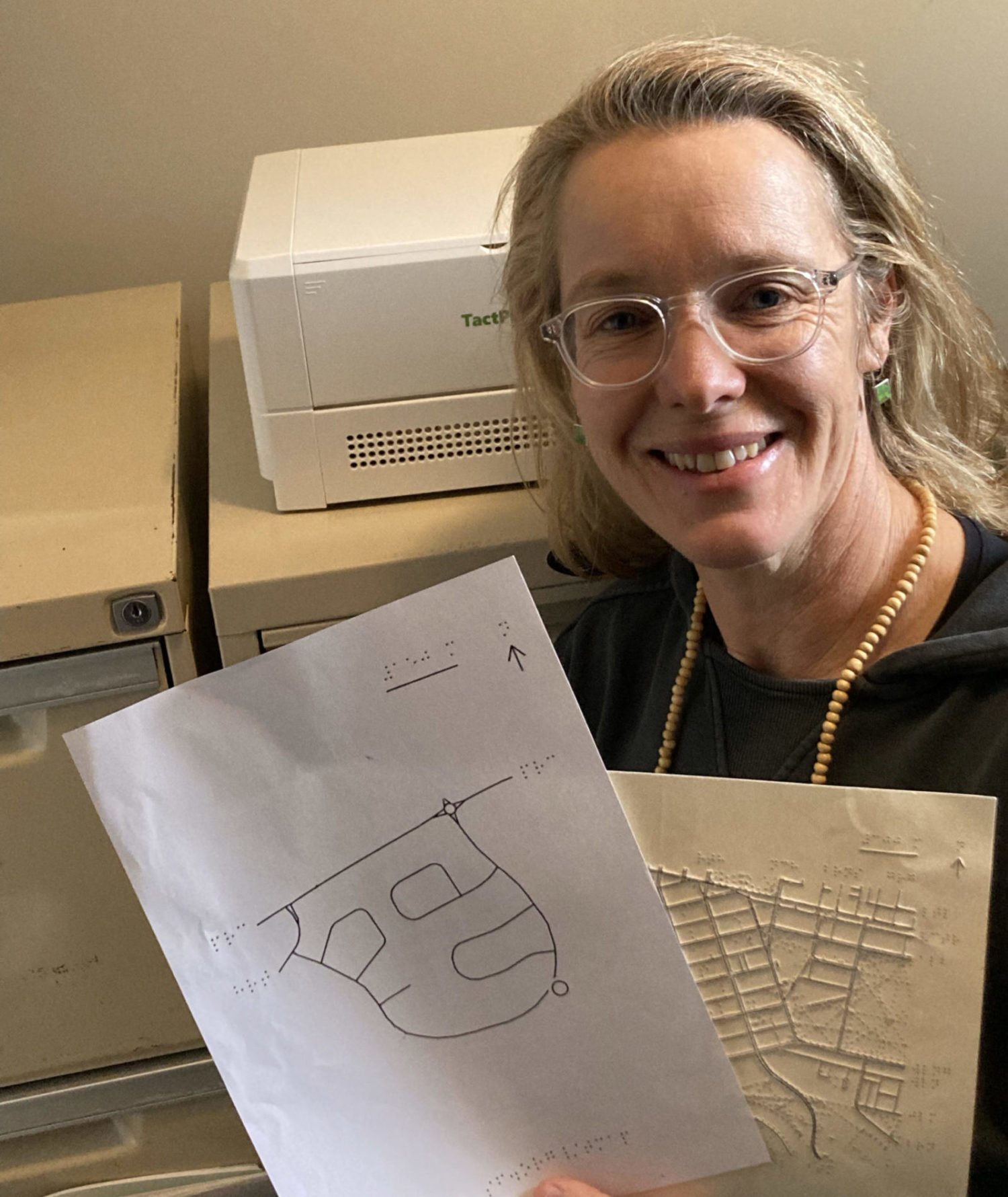
Since 2016, LightHouse’s Media and Accessible Design Laboratory (MAD Lab) has been continuously developing their innovative Tactile Maps Automated Production (TMAP) software and perfecting its outcoming product. TMAP, a tool to generate tactile street maps, has grown since its early days and has become a widely used Orientation & Mobility (O&M) tool among O&M instructors and blind and low vision travelers. The expansion of TMAP is due to MAD Lab’s reliable presence at O&M conferences, webinars, and various blindness podcasts and presentations.

We are proud to announce that TMAP has made its way across the world! We chatted with O&M instructor Angela Reynolds of the Orientation and Mobility Association of Australia (OMAA) about her experience with TMAP.

How did you discover TMAP?

“I heard Greg Kehret [Director of LightHouse’s MAD Lab] talking about TMAP on Kassy Maloney’s podcast ‘A Step Forward’ in February this year. I thought it sounded like a great practical resource and immediately created an account and started experimenting with it.”

What was your experience/relationship with tactile maps before discovering TMAP?

“I commenced working as an O&M in 2001. Early in my career, I had access to PIAF [Pictures in a Flash] machines in the offices I worked in so I would create tactile maps when required. For the last 15 years I’ve worked in a country region in northeast Victoria, and I’ve worked from home, our office is a three-hour drive away. This means I don’t have a PIAF machine or any type of embosser at my disposal. If I need a tactile map, I have to be very organized and create and order the map at least three weeks in advance to ensure I had it in time for the O&M session. At times, I have to admit, it was difficult to be this organized or predict the need for a map this far ahead. Sometimes during a session, it would become clear that a client would benefit from a map to increase their spatial understanding of a travel route, but I simply couldn’t get the map created in time for the next session.

“To address these gaps, I crafted my own maps. I used a variety of materials to do this such as cardboard strips pasted onto cardboard to create street maps. Often clients would assist by creating the braille labels so it would be a collaborative process. Other times I’d create a quick map when we were on the go during an O&M session by using a magnetic board and magnetic strips and symbols that I’d created, often embellished with Wiki Stix, foam stick on symbols and tactile dots. I’ve made maps out of lollies [candy] with children and larger street maps out of cut out pieces of wood, sandpaper and felt.

“I think maps are so important to develop spatial understanding so people can start to create a mental map of the areas they’re travelling through, so I pursued many options to create maps, however it was time-consuming because of how long it took to create a map.”

How has having a TMAP account affected your work?

“I’ve been so excited to discover TMAP! It has filled some major barriers that I was experiencing with my capacity to provide good quality and timely maps to clients. I’m very impressed with how easy it is to use, the ability to set a scale to provide a big picture map or a more detailed smaller view of an area, the north compass rose, the key and the embedded braille, braille, did I mention braille?! The braille is a major game changer. The other aspect of TMAP to create tactile maps is how quickly I can create a map, it’s so fast and I can quickly download it to my computer and email it through to another staff member and request them to put it through the PIAF machine for me.

“Since I’ve had access to TMAP is has reinvigorated my passion for tactile maps. It’s also resulted in me revisiting and thinking about the development of foundational O&M skills and how to teach tactile mapping skills to both children and adults. Map reading is a learnt skill, and the skills of tactile mapping are learnt in a graded and methodical way.  Even with the emergence of GPS technology there remains a strong need for tactile maps to increase spatial skill development, mental mapping and to use as a tool for enhanced and accessible learning of travel routes and environments.

“Due to the maps being sourced via Open Street Maps I find that the resulting maps are accurate and can really add value to the development of the conceptual understanding of the shapes of roads. And the TMAP software is working well in Australia and the fact that it’s free is also so exciting.”

How have your clients responded to working with TMAP?

“I have been providing services to a lady for a number of years on and off. She lost her vision due to retinoblastoma when she was 17 months old. She is an avid map lover and often requests maps from me so she can increase her spatial understanding of the areas she travels. Prior to TMAP, I had been crafting cardboard street maps and trying to put them together to create a big picture of the two towns she travels in regularly. Each map took me about 2 hours to make and there were issues with scale when we put them together. I am no cartographer! She was doing the braille labels and we’d stick them on together. Ultimately, I couldn’t keep up with her requests for maps, she wanted more, and I didn’t have enough time in my day to make the maps. This year when I discovered TMAP I was able to pump out multiple tactile maps for her so quickly and we spent several hours excitedly going over the maps together. This is also the other aspect that I really love about TMAP tactile maps, is the ability to sit down and share the experience of reading and looking at a map. She had the Braille version, and I had the text version and we read the map together in a really natural way. It felt accessible to both of us. Through TMAP, she learned that the street she has lived on for 25 years had a pronounced curve, it was curved like the shape of a horseshoe or the print letter U. She had always thought her street was straight.”

Since LightHouse chatted with Angela, she presented a paper at the Orientation & Mobility Association of Australasia online Symposium in Australia back in September. Our MAD Lab director, Greg Kehret, joined Angela for a joint presentation about TMAP. There has been a very positive response following the presentation, and several more O&Ms in Australia have created their own TMAP accounts and are starting to experiment and create tactile maps for their clients, as well. Nothing fills our hearts and fuels our ambition and dedication more than hearing feedback like Angela’s. LightHouse is thrilled to see MAD Lab’s services are vastly expanding and positively changing the lives of blind and low vision individuals worldwide. “I often highly recommend TMAP to other O&M’s,” Angela tells us.

Don’t have a local embosser but still want TMAPs for you or your students? No problem. LightHouse can produce the maps and mail them to you. Order online at Adaptations.org or call 1-888-400-8933.

TMAP FAQ and Troubleshooting

  1. About TMAP: General questions about the TMAP app and the maps it can make. Also see About TMAP page
  2. Getting TMAPs: Questions about maps from Adaptations and about getting a user account.
  3. Using TMAP to make your own tactile street maps: Questions about the TMAP app, how it works, bugs, and technical stuff. Also see How to Use TMAP to Make Maps page
  4. Printing TMAPs: Questions about printing TMAP files. Also see Printing Instructions page
  5. On the Map: About the actual map, and what’s on it. Also see About TMAP page
  6. Reading or teaching TMAPs: Questions about what’s on a TMAP, how to read it, and how to use it. Also see Reading Tactile Maps page

1. About TMAP

General questions about the TMAP app and the maps it can make.

What is TMAP?

TMAP is a tool to generate tactile street maps. Tactile Maps Automated Production (TMAP) is a project of LightHouse for the Blind and Visually Impaired and Smith-Kettlewell Eye Research Institute.

How much area does a TMAP cover?

TMAPs can range from a few blocks to a few miles wide, depending on the map scale and paper size. TMAP can generate maps at six different zoom levels, from 1:1500 to 1:50000. For more about map scale, see What is map scale?

Can I get a map of anywhere?

TMAP works best for addresses within North America. It can generate maps of addresses outside North America, but results may vary.

What kind of maps can I get from TMAP?

TMAP makes tactile street maps, ranging from a few blocks to a few miles wide, using raised lines and textures to represent roads, pedestrian paths, railways, and buildings (when the data is available). Maps include braille and large print street labels, north arrow, scale, and key.

Can TMAP make campus maps?

Yes, with a caveat. TMAP can make maps showing streets, service roads, paths, and buildings (when the data is available), which are all essential features on a campus map. TMAP will not label buildings, quads or path names. Most campuses are too large to fit on a TMAP while remaining legible. If you would like a campus map, we recommend that you contact MAD Lab to customize a TMAP to best fit your needs. Or fill out our contact form.

Can TMAP make maps of cities, states, and countries?

No, but our skilled design team can create custom maps. Contact MAD Lab or fill out our contact form. Also check out Adaptations map collection.

Can TMAP make maps of floor plans or building interiors?

No, but our skilled design team can create custom maps. Contact MAD Lab or fill out our contact form.

Are digital TMAP files screen reader accessible?

No. TMAP produces SVG and PDF files that are designed to be embossed. If you would like to collaborate with us to create an accessible digital map, get in touch.

2. Getting TMAPs

Questions about maps from Adaptations and about getting a user account.

How can I get a TMAP?

You can order a map from LightHouse’s Adaptations store or call 1-888-400-8933. Alternately, if you have an embosser or tactile printer, you can create and print your own maps. Sign up here.

What do I get when I order a TMAP from Adaptations?

You will receive an introductory page along with two maps of the same address—one map zoomed-in, with streets, paths, and railways, if data is available, and one zoomed-out with streets only. Please specify special requests to the product specialists at the Adaptations Store when ordering your TMAP.

Can I print my own maps?

Yes. If you have an embosser or tactile printer, you can create and print your own maps. Sign up for a TMAP user account. TMAP produces SVG and PDF files suitable for printing on ViewPlus embossers, PixBlaster, and Swell/capsule paper. See Printing Instructions for more information.

Can you add features to my TMAP?

Yes. TMAPs show streets and labels for streets that meet the edge of the map, paths, railways, and a locator dot on the map’s address. If you would like additional labels, buildings, or multiple points of interest, our skilled design team can customize your TMAP. Email us or fill out our contact form.

3. Using TMAP to make your own tactile street maps

Questions about the TMAP app, how it works, bugs, and technical stuff.

How does TMAP work?

TMAP uses Google Maps to search for an address, intersection or landmark. TMAP uses the resulting coordinates to pull data from OpenStreetMap, creating separate SVG files for each: tactile map page, print map page, tactile key page(s), and map key page(s). When you download a map file, TMAP combines the SVG files into a PDF optimized for 2-in-1 emboss on a ViewPlus printer. Also see How to Use TMAP to Make Maps and Printing Instructions.

Which browsers are compatible with the TMAP app?

We recommend using Chrome, Firefox, or Safari.

What does Map Scale mean?

See What is map scale.

TMAP error: “We’re sorry, it looks like there are no results for that address or location.”

This happens when Google cannot find the address you are searching. A few things to try: check spelling; omit apartment numbers; use either city or zip code, not both. Try your search in Google maps. If it gives you a “partial match,” then try a different address. If it finds your searched address, please contact us.

TMAP error: “Sorry, there was an error.”

Please contact us, specifying the address, as well as setting for paper size and scale. This can happen when a street label contains an uncommon character. We will try to address the issue as soon as possible.

Is this a bug?

Despite our best efforts, there might be bugs. If you think you’ve encountered a TMAP bug, please contact us. Sometimes what appears to be a bug was an intentional design decision. We will attempt to respond to all questions and feedback but cannot offer technical support at this time.

4. Printing TMAPs

Questions about printing TMAP files.

Which embossers or printers can print TMAP files?

TMAP is designed for ViewPlus embossers with 2-in-1 printing capabilities but can also be printed on tactile-only ViewPlus embossers (like VP Columbia or VP Delta), on APH PixBlaster, or on capsule paper (Swell, Zychem, PIAF). Since the braille font is intended for ViewPlus embossers, braille on capsule paper may be low. See Printing Instructions.

TMAPs can also be embossed on Index (using TactileViewTactileView-US), though at a lower resolution than ViewPlus.

Since MAD Lab does not have Juliet or Romeo embossers in our shop, we have not tested their TMAP printing capabilities. Please email us to let us know if you have success printing to these embossers, and we will happily share your tips.

The braille seems off, either too big, too small, too squished, or too low.

If embossing on ViewPlus, check that you ran the TMAP PDF through PDF Unembed Fonts, and that you printed from the file with _VP at the end. Disclaimer: this does not always solve the issue. See Printing Instructions page.

If printing on Swell or capsule paper, check that you printed the file at 100% scale or actual size, not ‘shrink to fit’ or ‘fit to page’. The braille font on TMAPs is intended for ViewPlus embossing, and is slightly smaller than Swell-Braille font, so it might be lower than desired. Braille near the edge of the page may not swell as high, and not all Swell/capsule paper is created equal.

5. On the Map

About the actual map, and what’s on it.

What is on a TMAP?

TMAPs are titled with an address, marked on the map with a locator dot. Each map has a north arrow, as well as a scale line and the equivalent real-world distance. By default, maps contain streets and labels for streets that reach the edge of the map. Maps can also show paths and railways (and buildings upon request), when the data is available. Each map comes with a corresponding key. Map files contain both braille and print text. Maps purchased from Adaptations are embossed and printed with ink, containing both tactile and visual information. Download Introduction to TMAP page.

What material is the map?

TMAPs produced by the MAD Lab are embossed and printed onto heavy cardstock (paper) using a ViewPlus EmFuse 2-in-1 printer, combining tactile and ink-print onto a single page. Both map and key pages contain braille and large print text, tactile and ink graphics.

Can I get my map in Grade 2 Braille?

No. The braille on the map and key is uncontracted (Grade 1), Unified English Braille (UEB). We hope to add a contracted braille option in the future.

Why aren’t all the streets labeled?

Our automated mapping system uses an algorithm to determine which streets are labeled and how. Only streets that meet the edge of the map are labeled to prevent clutter. A street may not be labeled due to space constraints, lack of street name or lack of data from OpenStreetMap (where TMAP data originates).

Why is there no title on my map?

This may be a bug in our software or an error with the address used to make your map. This can occur on maps outside North America, or for maps of a park or open space without a defined address. If ordered from Adaptations, please contact us to determine if there was an error in the production of your map. If generating your own map, also see How to Use TMAP to Make Maps.

What is map scale?

Map scale is the relationship between distances on a map and the world it represents. We represent map scale as a ratio, with the first number (1 in our case) as 1 unit on the printed map, and the second number (1500, 2500, … 50000) as the number of units it represents in the real world. The default TMAP scale is 1:5000, which means 1 inch on the map represents 5000 inches in the real world. Since we’re talking about units, it could also be 1 foot on the map represents 5000 feet in the real world.

Examples of what each scale might show in an urban area on 11.5 x 11-inch paper:

  • 1:1500 – intersection
  • 1:2500 – 1-4 block area
  • 1:5000 – 8-12 block area
  • 1:12500 – neighborhood, 6-8 blocks wide
  • 1:25000 (not recommended for urban areas due to density) – college campus overview
  • 1:50000 (not recommended for urban areas due to density) – part of regional park

For detailed information about available scales, see the table below:

Scale Scale line length on map (feet) 11.5 x 11 map width (miles) 8.5 x 11 map width (miles) 17 x 11 map width (miles)
1:1500 50 0.07 0.04 0.12
1:2500 100 0.14 0.09 0.23
1:5000 (default) 250 0.28 0.18 0.47
1:12500 500 0.56 0.36 0.93
1:25000 1000 1.12 0.72 1.87
1:50000 2500 2.25 1.44 3.73

6. Reading or teaching TMAPs

Questions about what’s on a TMAP, how to read it, and how to use it.

Can you modify a TMAP, add labels, remove unnecessary streets, make lines bolder?

Yes. TMAPs show streets and labels for streets that meet the edge of the map, paths, railways, and a locator dot on the map’s address. If you would like additional labels, buildings, or multiple points of interest, our skilled design team can customize your TMAP. Email us or fill out our contact form.

How can I customize TMAPs myself?

We recommend customizing maps to meet your or your student’s needs, either using a collage method, or digitally. You can open or import SVG or PDF files into a variety of design programs (Adobe Illustrator, Adobe Reader, Inkscape, TactileView), and add or omit elements. Be sure not to resize the map, as the braille will not print correctly. TMAP uses Braille29 font, 29pt font size.

Can TMAP be used to teach routes through distance learning?

Yes. Teachers and O&M instructors use TMAPs to pre-teach routes around students’ neighborhoods or routes near their schools or workplaces. Also see Reading Tactile Maps and Putting the Mobile in Mobility.

Do you have any materials to build tactile reading skills in preparation for reading TMAPs?

Tactile Intersection Diagrams are for sale at the Adaptations store. You can also download mazes and print them yourself on capsule paper.


TMAP Printing Instructions

When you download your TMAP, you will find a ZIP file with a PDF and 4 (or more) SVG files. The SVG files are Tactile Map page, Print Map page, Tactile Legend page(s), Print Legend page(s). The PDF combines these SVGs to print on our embossers. TMAP files are designed to print on ViewPlus embossers, however they can also be printed on capsule paper (or Swell, PIAF, Zychem), or on Index. Results may vary.

TMAP files are intended for 2-in-1 printing, creating an embossed and ink-print document on a ViewPlus (or Tiger) embosser. ViewPlus embossers may incorrectly print braille from PDFs. To mitigate possible braille errors, complete the steps outlined below. This creates an additional PDF with fonts unembedded, filename ending with “_VP”, ready to emboss. (Please note, this step is only for embossing to ViewPlus, and is not necessary for Swell or capsule paper.)

  1. Download the PDF Unembed Fonts tool from the ViewPlus Downloads page (for Windows only).
  2. Run PDF Unembed Fonts (see sections below: with a mouse or in command line)
  3. Open the PDF with _VP in Adobe Acrobat or Reader. Send to printer. In print settings:
    • Check the Tiger tab to optimize results. Printing “draft” quality is not recommended. On ViewPlus Columbia/Delta or APH PixBlaster, Graphics Quality: Best.
    • Check that the paper size matches your TMAP file paper size.
    • Check that the paper orientation matches your embosser output.
  4. Important! If printing tactile-only (NOT using 2-in-1 printing), send odd-numbered pages only (1, 3, etc.).
  5. Print.

Running PDF Unembed Fonts with a Mouse

  1. Create a shortcut to the Unembed program on your desktop.
  2. Drag the PDF on top of the Unembed shortcut icon or browse to the file from the Unembed Fonts tool. This will create a new file with _VP at the end in the original folder.

Running PDFUnembedfonts in Command Line

  1. To ensure the shortest file path, after extracting it is recommended to copy the entire PDFUnembedFonts folder to the root of your C drive (or an external drive). For economy of file path it is further recommended that the PDF also reside in this folder.
  2. From the start menu, Search programs and files, type cmd. Hit Enter.
  3. To point it to the specific directory type cd space c:\pdfunembedfonts
  4. Now to actually run the script on your PDF type pdfunembedfonts space .\filename.pdf. Hit Enter.
  5. If all went well c:\pdfunembedfonts should now contain a version of your PDF, the file name appended with _VP

Though TMAP file can be printed on capsule paper, the braille font is not optimized for this method, and results may vary.

  1. Open the PDF (Adobe recommended). Send to printer. In print settings:
    • Check that the paper size matches your TMAP file paper size.
    • Check that the paper orientation matches your printer output.
    • Print at 100% or Actual Size. Do not “fit” or “shrink to fit”.
  2. Choose braille or large print map:
    • For a map with braille text, send odd-numbered pages only (1, 3, etc.).
    • For a map with large print text, send even-numbered pages only (2, 4, etc.).
  3. Print.

Related Pages: TMAP Main page, Frequently Asked Questions, How to Use TMAP to Make Maps, Reading Tactile Maps, Learn more about TMAP

How to Make a Map Using TMAP

TMAP generates files of tactile street maps, which can be printed with an embosser or on microcapsule paper (either with a PIAF or Swell machine).

TMAP is optimized for Chrome, Firefox, and Safari.

Overview

Steps to producing a tactile street map:

  1. Search an address, intersection, or landmark.
    • If search results are ambiguous, choose between several options or search again.
  2. Create the map. Confirm the map address and choose map settings and features.
  3. Download or email the map file.
  4. Emboss or print the map using a ViewPlus (also called Tiger) embosser or Swellform machine, PIAF, Microcapsule paper. Printing Instructions. Or you can contact Adaptations to print and ship the map.

Step by Step Instructions

1. Search Page, where you search for an address

Starting on the Search Page where it says “Welcome to TMAP”, enter an address, landmark, or intersection into the search bar. This search uses Google maps information, so if Google maps recognizes your search query, TMAP will too. This means you can enter names like “Civic Center BART Station”. You can also enter an address, city, and state, omitting the zip code. You can also enter a street address and zip code only, without city or state. Click the Search button.

2. Map Preview Page, where you create a map

You should find yourself on a map preview page showing the address, features and settings options, and a visual map preview. If you do not get the result you were hoping for, search for a new address from the search bar or click on the TMAP logo to go back to the main search page.

2a. Map Preview Page: confirm map address

Check that your map is of the correct location. After the search bar reads “Create map for” followed by the address TMAP found from your search. Is this address correct?

If this address is not what you expected or does not match the address you think you searched, check spelling or try omitting apartment numbers. If you enter an address that Google is unsure of, or is ambiguous, like “Main Street”, TMAP will give you a list of options, showing you a preview of maps of various Main Streets in different cities. Select one of the options, if any are correct, or add city name or zip code for better results.

If you want to make a map of this address, you can continue on to choose settings and add features to your map.

2b. Map Preview Page: settings

Once you have confirmed the map address, choose your preferred paper size, map scale, and distance units.

  • Paper size depends on your printer or embosser, and amount of information you want to show on the page.
  • Map scale is how zoomed in or out you want to be, how much information you want to show on the page, or how dense you want the map to be.
  • Distance units is feet or meters.
  • The default settings are 11.5 x 11-inch paper (standard braille paper size), 1:5000 scale (or about ¼ mile on braille paper), and miles.

2c. Map Preview Page: features

Now comes the fun part where you get to add features to the map. You have the option to include streets, paths, service roads, and railways. (Buildings are currently unavailable, but will be back soon.) We have tried to match the look and content of the map preview to the TMAP output, but occasionally you will notice differences, especially around railways that go underground. Some things to know about features:

  • By default, streets are checked.
  • Checking or unchecking these buttons will not change the map preview.
  • On the map preview, the thicker solid lines are streets, thinner solid lines are service roads, dotted red lines are paths, and dashed lines are railways.
  • All of the data we use to generate map is from OpenStreetMap, an editable, opensource map of the world created by volunteer mapmakers. If someone has not yet mapped the path by your house, it will not show up on TMAP. If you notice something important missing (like your favorite walking trail), please contact us and we will try to add it in to OpenStreetMap.
  • We do not recommend checking all the boxes for every map. Though this may be tempting, it will create a very cluttered and potentially illegible reading experience.
  • For zoomed in map, it’s ok to include paths, service roads, and railways.
  • Service roads are things like alleys, bus lanes, and main routes through parking lots (we have omitted smaller parking lot aisles to eliminate clutter). If these are significant to the reading of your map, then include them. If not, it’s best to omit them.
  • We recommend caution when selecting railways and paths on maps covering large areas since they can blend in and overlap too much with streets, but the density of your map varies based on location, so experiment and play around with it.

2d. Map Preview: pan

By default, the address you searched is in the center of the map preview box. If using a mouse, you can pan to the area you want to print by clicking, holding, and moving any part of the map. If you drag your address outside of the map preview, the center locator dot will no longer appear on your printed map, though the map will still be titled with your searched address.

2e. Map Preview: zoom

If you change map scale from the dropdown above the map, the preview automatically zooms in or out. You can also click on the plus and minus buttons at the top right corner of the map preview.

2f. Create Map

Once you have chosen a paper size, map scale, distance units, and map features, click the Create Map button. This will bring you to the File Preview page where you can download or email the map file.

3. File Preview and Download

On the File Preview and Download page, you have another chance to confirm your map choices. This page reads “Download map for” and lists the address TMAP found from your search. There is also a visual preview of the generated file, showing the print version of the map with streets, street name abbreviations, and any features you selected that appear on the map.

If you aren’t happy with the file preview, you can navigate back to the previous page to edit your selections. If you click the back button on your browser, all settings except map features will be saved (except on Safari, you lucky mapmaker).

If you are happy with the file preview, you can click Download or Email. Emailing the file simply sends the TMAP files to the email address you’ve entered. It will come from tmaps@lighthouse-sf.info When you download your TMAP, you will find a ZIP file containing a PDF and 4 (or more) SVG files. The SVG files are Tactile Map page, Print Map page, Tactile Legend page(s), Print Legend page(s). The PDF combines these SVGs to print on our embossers.

4. Print or Emboss

Now print your map! See Printing Instructions

Having trouble? Check our Frequently Asked Questions or contact us. Check out our recent presentation (demonstration at 17:55).

Order TMAPs from Adaptations.org

Related Pages: TMAP main pageHow to Use TMAP to Make Maps, Reading Tactile Maps, Download Introduction to TMAP page, Learn more about TMAP

About TMAP

How can someone without eyesight learn a city block or navigate a new neighborhood? In 2018, the LightHouse of the Blind and Visually Impaired – SF introduced TMAP: Tactile Maps Automated Production, offering on-demand tactile street maps.

Covering an area of several blocks surrounding a given address, TMAP uses both braille and large print to identify streets, represented by crisp, raised lines that can be easily followed with the fingertips.

TMAP is a collaboration of the LightHouse for the Blind and Visually Impaired, and the Smith-Kettlewell Eye Research Institute.

Side by side key and tactile map of 1155 Market Street showing braille and print text, tactile and ink street lines.
TMAP of the LightHouse Building location in San Francisco, CA.

Order a map for $26.25

To order a map, call our product specialists at 1-888-400-8933 or or visit adaptations.org and specify the street address of the map you’re interested in receiving. Within two business days we’ll ship you your map.

What’s in the package?

  • You will receive two maps of the same address, a zoomed-out overview map, and a zoomed-in detail map showing streets, paths, and buildings, if the data is available
  • A tactile map key
  • An introductory page (download intro page)
  • All materials are printed on 11” X 11.5” sheets of embossed paper and include ink / large print labels in addition to braille

Learn more about the MAD Lab where these maps are produced.

Contact

Recent Presentations: At Home With APH: TMAP – Building Environmental Literacy at a DistanceMobility Matters 2020 Slides, Mobility Matters 2020 Video Presentation

Related Blog Posts: Maps, at your Fingertips, New local tactile maps at Adaptations

Love maps? Sign up for our newsletter!


Maps for the blind: How the MAD Lab is challenging designers’ hyper-visual assumptions

Maps for the blind: How the MAD Lab is challenging designers’ hyper-visual assumptions

For the experienced blind traveler, obstacle avoidance is not the overwhelming part—that’s why we have canes, dog guide and blindness skills. The challenging part is getting familiar with the lay of the land in order to make the spontaneous choices of everyday life, like which quirky cafe to duck into or how to get to the canal everyone keeps telling you to wander along.

And if you’re a sighted traveler, it’s easy to take mapping tools for granted with GPS apps at your fingers. Most people don’t realize that blind people don’t have easy access to non-visual or ‘tactile’ maps. (You might be asking: what’s a tactile map? It’s pretty simple—it’s a map with raised lines and braille markers that you can feel.)

That’s why the LightHouse Media and Accessible Design Lab hosted a Maptime SF/Oakland meetup last month: to teach multidisciplinary designers about accessible methods to use when creating maps and encourage them to incorporate tactile information into their work.

Attendees came from a wide swath of industries and design disciplines. The MAD Lab team hosted designers from Apple, architects from Arup, graphic designers, transportation specialists, programmers, students in interactive design, occupational therapists, special ed teachers, ocean mapping specialists, and highly skilled cartographers.

After comparing and contrasting examples of different design methods and discussing their effectiveness, Maptimers used these precepts to make their own maps. The group also discussed Tactile Maps Automated Production, and how this automated mapping system is a game changer for tactile map production.

“There’s such a lack of tactile graphics in the world,” says MAD Lab Senior Designer Naomi Rosenberg. “The only way to increase tactile graphic production is to teach more people how to incorporate tactile information into their designs. Sharing our expertise in tactile graphics empowers specialists in other fields to step outside of their normal design process, and design better for their audience and underrepresented audiences.”

Photos from the workshop

Take a little tour of their design process below. And if you’re sighted, next time you walk down the street or hop on Google maps, start to consider the lack of non-visual information that is available to tell you how to get around. If you’re a designer, it might just change how you approach your own designs.

Workshops like this support the MAD Lab’s goal of making visual information accessible to people who are blind and visually impaired. Ready to get your hands on your own tactile map? We can quickly create an inexpensive personalized map for you centered on a square mile anywhere in the US – visit or call the Adaptations Store to order! Stop by  at 1155 Market St. or give our specialists a call at 1-888-400-8933.

LightHouse will take over as distributor of Sendero Map and GPS products

LightHouse will take over as distributor of Sendero Map and GPS products

The LightHouse for the Blind and Visually Impaired in San Francisco is proud to announce its takeover as the manager and distributor of Sendero Group-manufactured GPS products. The LightHouse will run Sendero Maps and Sendero’s GPS product, which will continue to function normally.

Sendero’s PC Maps and GPS serve the blind and visually impaired community by providing detailed information to explore rural roads or city streets, intersection-by-intersection. The software allows users to record personal points of interest, hear their direction of travel, track distance travelled and collaborate with teachers, friends or family using integrated visual maps.

Sendero has been the frontrunner in accessible GPS technology since Founder Mike May and Chief Technology Officer Charles LaPierre launched the first accessible digital GPS map in 1995 at Arkenstone, their former travel technology company. That product turned into the forward-thinking, personal computer-based Sendero Maps and GPS, which the San Francisco LightHouse will now manage, in conjunction with its Tactile Maps Automated Production (TMAP).

This partnership will yield exciting new technological developments and retain Sendero’s existing products and functionalities. The Sendero mobile apps are slated for new features, and the Sendero Maps software will remain the same. LightHouse will also host the legacy BrailleNote and Braille Sense software, which were formerly available through Sendero.

To complement the PC-based products hosted by LightHouse, Sendero also announced that it is turning over its mobile navigation products to the subscription-based sighted assistance company Aira, who is acquiring Sendero’s iOS products for integration in their service.

Sendero’s GPS products will complement TMAP’s progressive approach to on-demand maps with their easy-to-use technology. There is no better way to learn a neighborhood than to pair the detail of digital maps with the spatial, geographic overview of a tactile map.

Sendero CTO, Charles LaPierre says, “I am thrilled that Sendero Maps and GPS products will continue under the stewardship of Aira and the LightHouse. In 1993, when I developed the first accessible GPS backpack prototype weighing 10 pounds, I said ‘In 10 years it will be the size of a Sony Walkman (TM), which will fit in your hand’. I am honored that my university project 25 years ago evolved into the ‘Swiss Army knife of life’ smartphone version of today.”

Under LightHouse superintendence in San Francisco, we hope to see Sendero products and services expand to serve more blind and visually impaired people worldwide — particularly with the highly anticipated launch of our online Adaptations Store later this year.

Behind the Map: Starting over in a new city

Behind the Map: Starting over in a new city

In January, LightHouse started offering TMAP — on-demand tactile street maps — for order at our Adaptations Store (1-888-400-8933). We have been hearing some amazing stories about how our maps are being used, so we wanted to share them with our mapping community.

One month ago, Lia Jacobsen sat on a plane, nervous. She was moving to Ann Arbor, Michigan after living in Washington D.C. for 10 years. The prospect of learning a new city after all that time was, admittedly, a bit daunting.

On the tray table in front of her lay two TMAPs: one detailing the area around her new home in Ann Arbor, and another of the streets around the University of Michigan School of Social Work, where she was beginning a masters degree. Leah traced her hands along the raised lines of the map, determined to memorize the criss-crossing, partial grid system of her new town. She reviewed the braille street names using each map key, learning the quarter-mile radius map first, then working her way out to the more dense and complex 1.5-miles radius map.

The flight attendant paused at Lia’s row, and politely asked: “Excuse me, ma’am, would you like me to turn your light on?” The question struck Lia as a bit absurd. Why would a person need light to read a raised-line tactile map? She tried to be polite but some snark crept into her voice as she expressed her confusion. It wasn’t until this moment that she discovered that the maps were more than just embossed paper: the streets were printed in ink, as well.

A TMAP of the University of Michigan.
Image: A TMAP of the University of Michigan.

The humor of the situation helped dispel some of her nerves, and since arriving in Ann Arbor and completing several weeks of classes, Lia pretty much knows the lay of the land.  

“My TMAPs were hugely helpful because when I landed I already felt like I knew where I was,” she says. “It automatically made me feel much more comfortable because I knew what I was passing.”

On her first day on campus she caught a group of lost undergrads off-guard when she interjected and gave them directions to their building.  

“It’s about being more equal and having the freedom not to rely on other people,” she says. “I tend to explore no matter what, but it gives me a foundation and a starting point so I don’t feel totally lost. Feeling lost makes you just want to go home.”

Lia wishes she had had access to TMAP throughout her many years working on the Obama campaign, traveling far and wide as a member of the Peace Corps, traveling alone in Colombia, or as a kid growing up in Florida.  

“I never had tactile maps growing up,” she says. “My first time having a sort of tactile map, my O&M teacher took a piece of felt and put some velcro beads on it and made a makeshift map.”

She expects to use TMAPs much more as she pursues her masters in social work and hopefully heads back to D.C. to become a victim advocate for the FBI.

“I definitely plan on purchasing more TMAPs whenever I move next time and have been spreading the word about how much I love the TMAPs to all of my friends who are blind,” she says. “The task of learning a new community after being in the same place for a decade was daunting, and the maps I purchased were enormously helpful in my feeling oriented from day one.”

Get your TMAP today

To order a map, call our product specialists at 1-888-400-8933 and specify the street address of the map you’re interested in receiving. Within two business days we’ll ship you your map, or make it available for pick up at the Adaptations Store (1155 Market St., 10th Floor, San Francisco, CA).

What’s in the package?

  • You will receive 3 map versions printed at simple, moderate and dense map scale ratios
  • A tactile map key
  • An introductory page
  • All materials are printed on 11” X 11.5” sheets of embossed paper and include ink / large print labels in addition to braille

Learn more about the MAD Lab where these maps are produced.

Love Maps? Sign up for our Map Love newsletter!

* indicates required