
Photo: Sarika Dagar
Our Mad Lab designers have been hard at work producing a set of new maps of our region. Never before have curious blind travelers had these tactile maps, and they can be acquired immediately from LightHouse’s Adaptations Store.
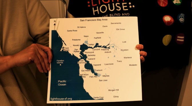
Here is a list of the available maps:
• San Francisco Bay Area Cities: Ever wonder where the heck Piedmont actually is? This map shows the major cities in the greater San Francisco Bay Area. $15
• San Francisco Bay Area Counties: This map shows the counties in the greater San Francisco Bay Area. Now you can see, for example, why Contra Costa County is actually north of Albany. $15
• San Francisco Bay Area Highways: You’ve heard of highway 13, or 237, or 92. Now you can see exactly where they are and how they connect. This map shows the main highways of the greater San Francisco Bay Area. $20
• San Francisco Neighborhoods: Just where does the Western Addition end and the Richmond District begin? Now you can find out. This map shows the neighborhoods in the city of San Francisco. $15
• California: Sacramento is actually more north than people commonly think. This map shows the state of California and its major cities. $20
Each map comes with braille and large print labels and is available for pickup. Get yours today by visiting our Adaptations store on the 10th floor at LightHouse Headquarters, 1155 Market Street in San Francisco. Or for extra convenience, just phone in your order and we’ll mail it to you. For more information call Adaptations at 1-888-400-8933 or email our store staff at adaptations@lighthouse-sf.org.