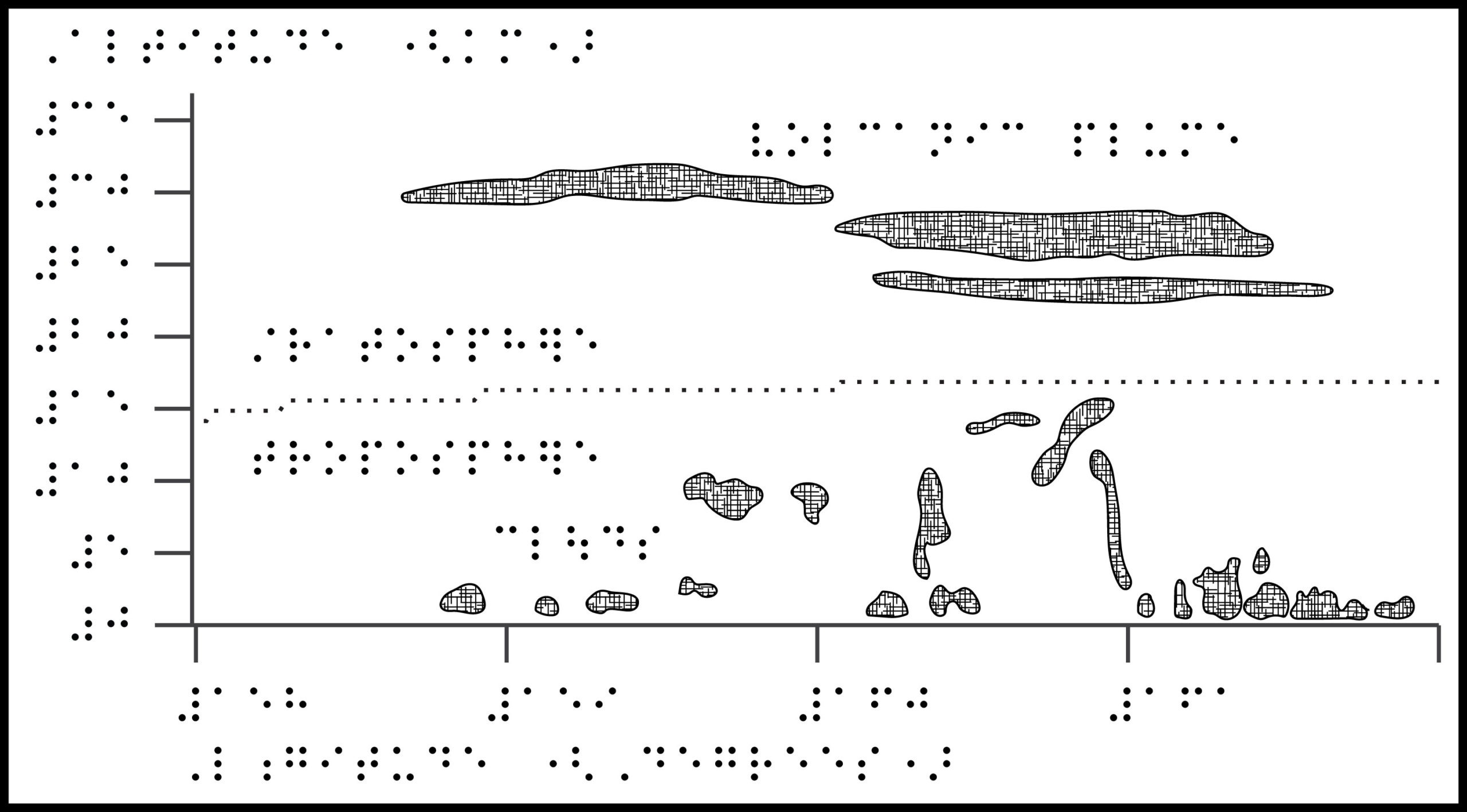
Title: Seeing back into the cosmos
Image description: Graphic illustrating the age of the universe in billions of years relative to how far back human telescope technology can see. The...
https://lighthouse-sf.org/wp-content/uploads/2022/05/SpaceTelescope_Featured-scaled-1.jpg14172560Naomi Rosenberghttps://lighthouse-sf.org/wp-content/uploads/2025/01/lighthouse-sf-logo.svgNaomi Rosenberg2022-05-13 12:00:542022-05-13 12:00:54How far will the James Webb Space Telescope see back in time?
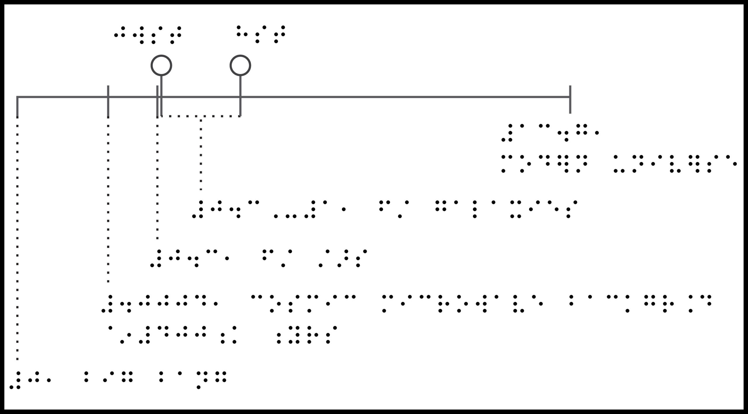
https://lighthouse-sf.org/wp-content/uploads/2022/04/GunRightsVControlSpending_Featured-scaled-1.jpg14182560Naomi Rosenberghttps://lighthouse-sf.org/wp-content/uploads/2025/01/lighthouse-sf-logo.svgNaomi Rosenberg2022-04-22 12:00:192025-03-10 07:09:17America’s gun culture in charts: gun rights vs gun control spending
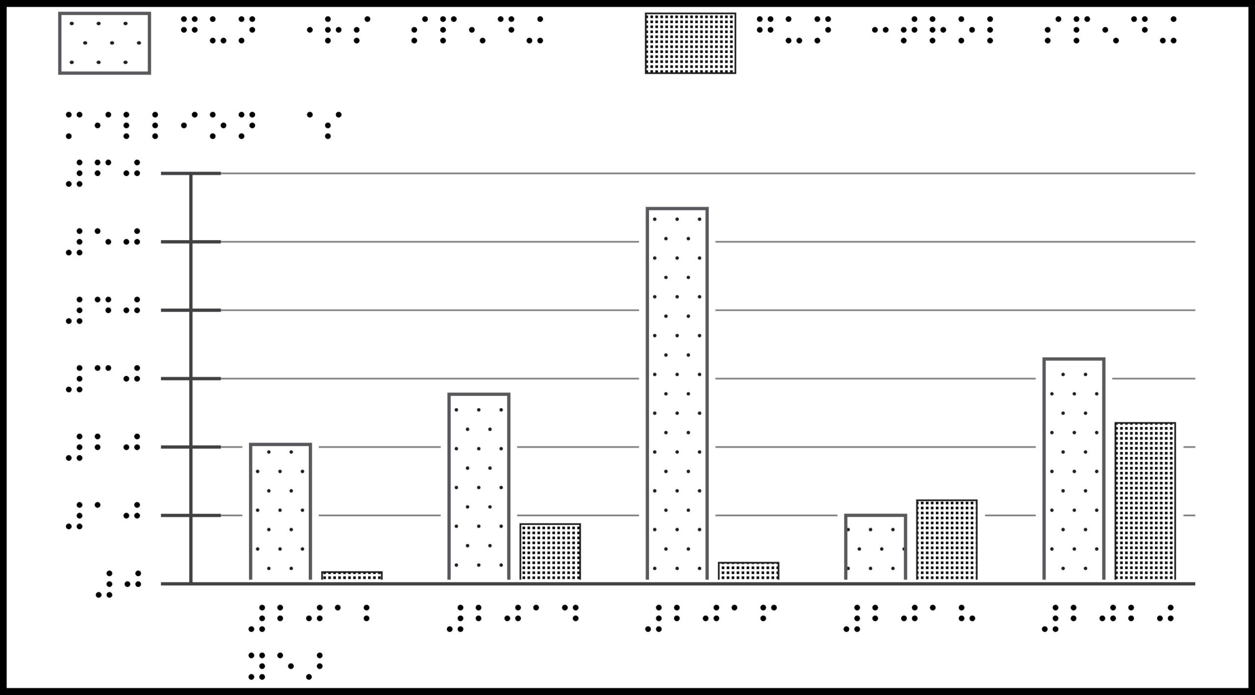
Title: Baseball Diamond
Image description: Aerial view of a Major League Baseball field, with infield at the bottom and outfield at the top. The bases are laid out in a...
https://lighthouse-sf.org/wp-content/uploads/2022/03/BaseballDiamond_featured-scaled-1.jpg14172560Naomi Rosenberghttps://lighthouse-sf.org/wp-content/uploads/2025/01/lighthouse-sf-logo.svgNaomi Rosenberg2022-03-25 12:00:042025-03-10 05:43:00What is the layout of a Major League Baseball field?
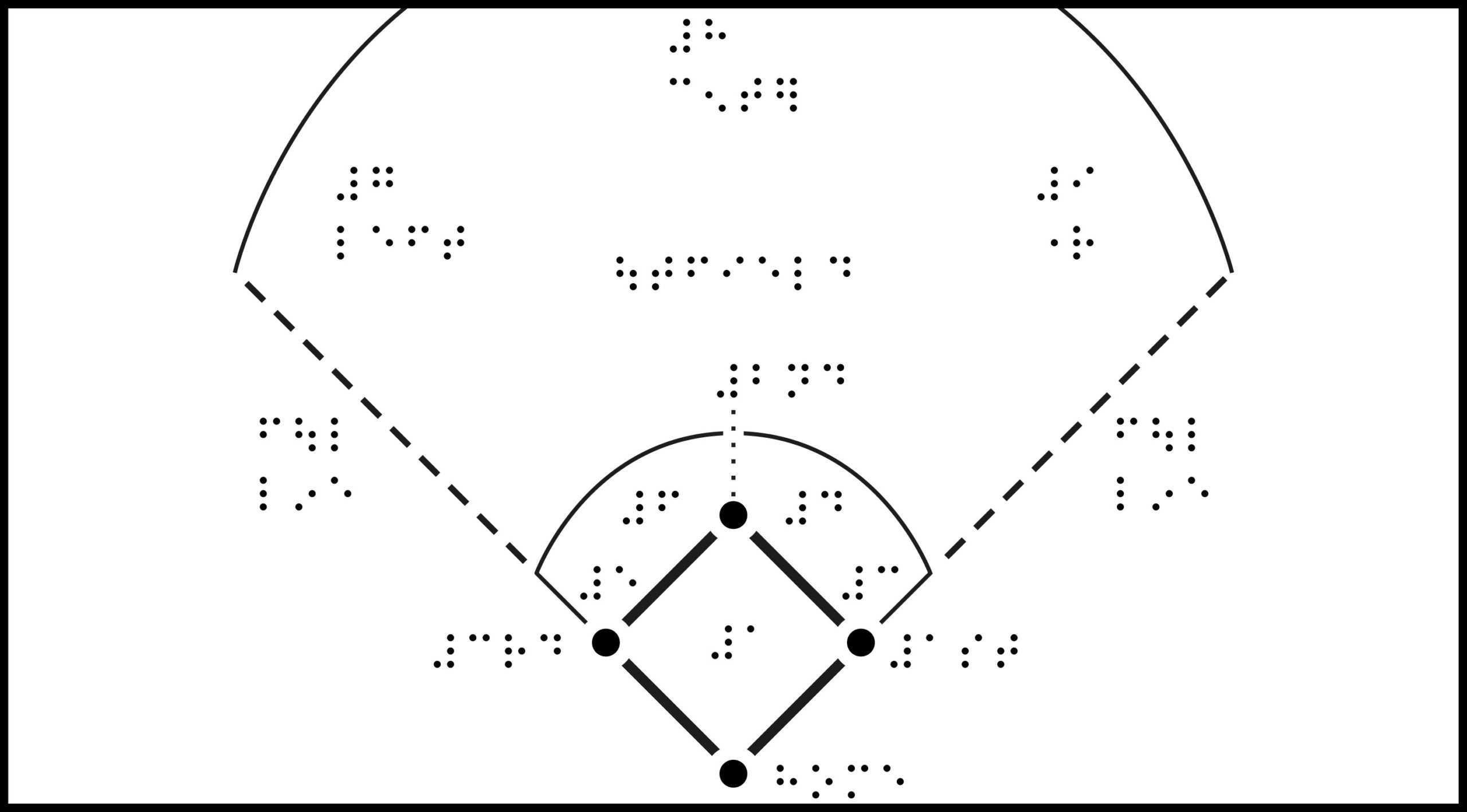
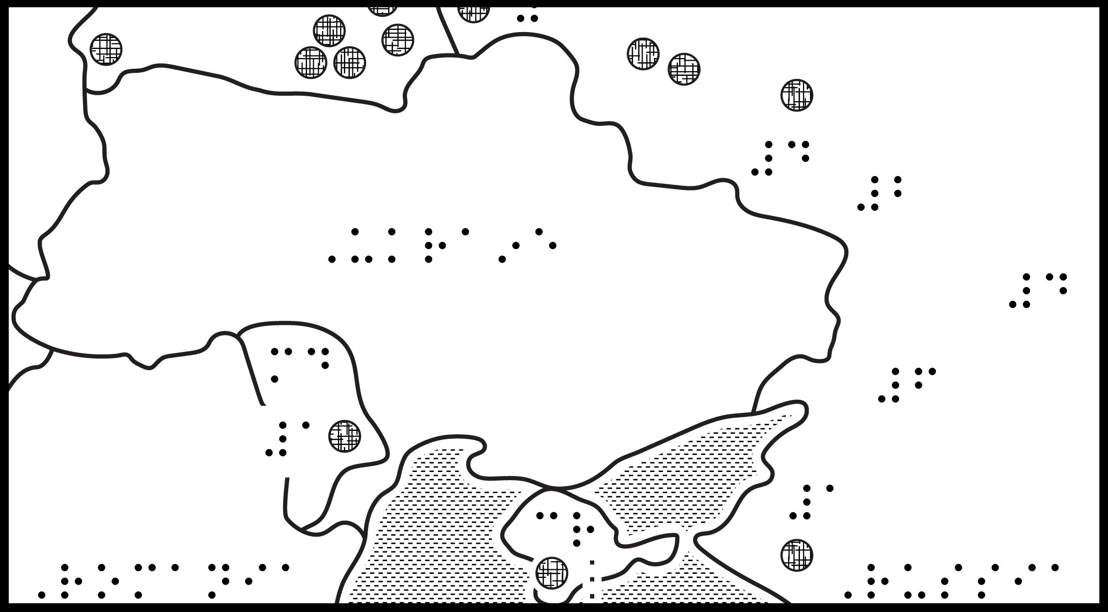
Title: Ukraine Map
Image Description: Map of Ukraine with bordering countries and prominent cities labeled. North is up; north arrow is omitted. Surrounding Ukraine, clockwise from the northeast, is Poland,...
https://lighthouse-sf.org/wp-content/uploads/2022/03/UkraineMap_featured.jpg11632101Naomi Rosenberghttps://lighthouse-sf.org/wp-content/uploads/2025/01/lighthouse-sf-logo.svgNaomi Rosenberg2022-03-11 12:00:112025-03-10 05:44:58Map of Ukraine, relevant cities and regions
Title: Tonga volcanic plume height
Image Description: Chart showing a 2-dimensional view of the stratosphere and troposphere. The y-axis shows Altitude, from 0 to 35 km. The x-axis shows Longitude, from 158 to 162...
https://lighthouse-sf.org/wp-content/uploads/2022/02/VolcanicPlume_featured-scaled-1.jpg14172560Naomi Rosenberghttps://lighthouse-sf.org/wp-content/uploads/2025/01/lighthouse-sf-logo.svgNaomi Rosenberg2022-02-25 12:00:262025-03-10 05:45:08How high was the Tonga volcanic plume?
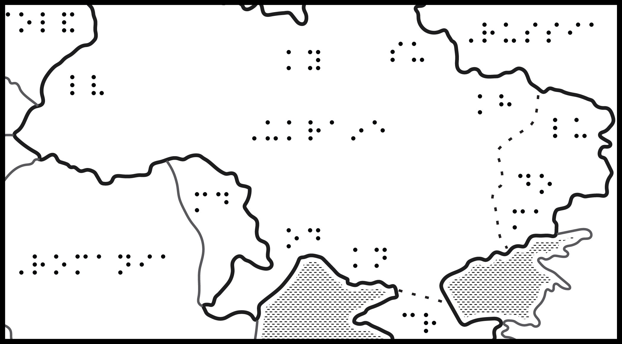
Title: Russian Troop Locations, Feb 2022
Image Description: Map of Ukraine and bordering countries, showing locations of Russia’s troops, both permanently stationed and newly arrived units. North is up; north...
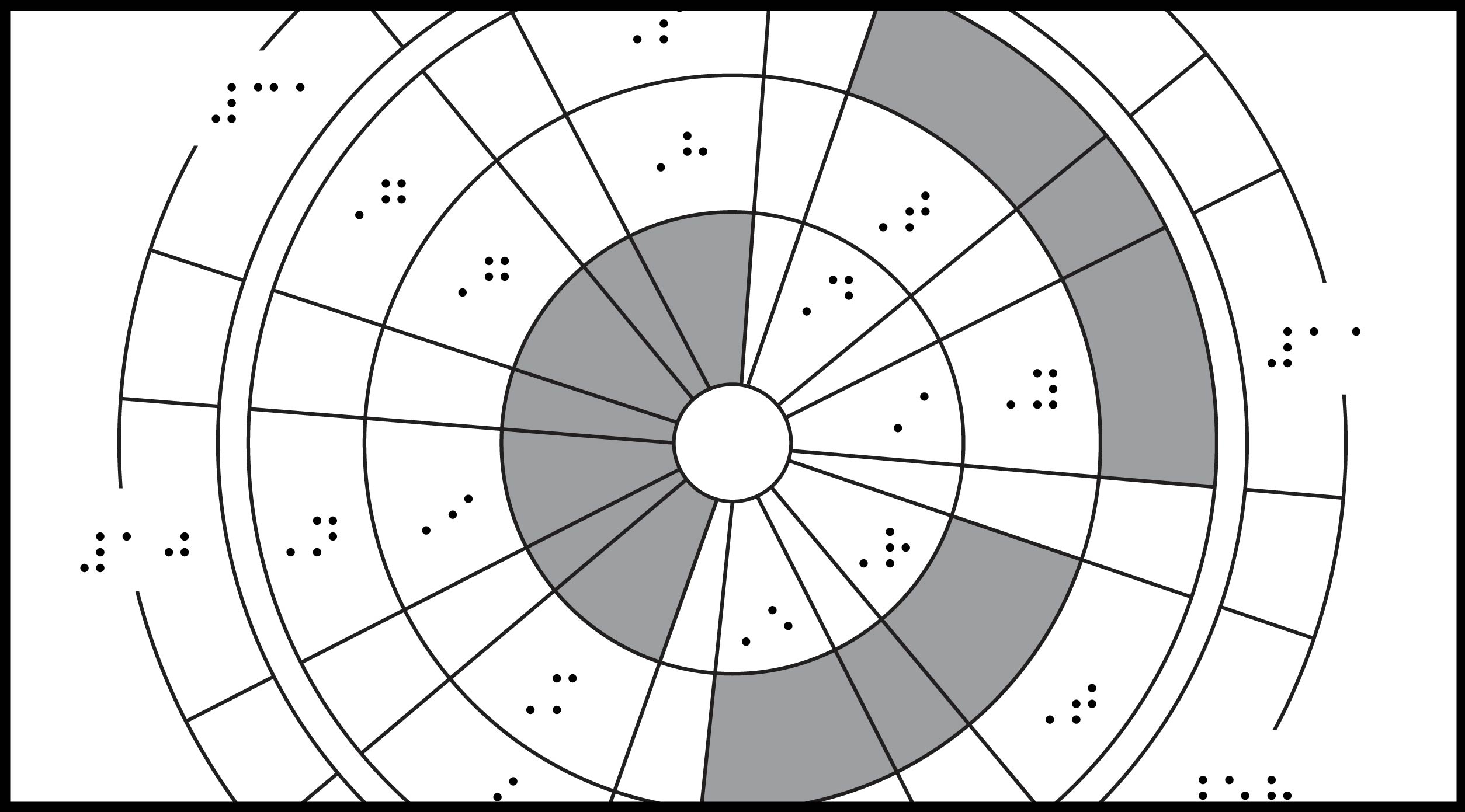
Tactile graphic 1: Perseverance Parachute
Description: Parachute viewed from below, showing patterned segments filled with orange, white, or a number or letter. The code along the outer circle is the coordinates...
https://lighthouse-sf.org/wp-content/uploads/2021/04/PerseverenceParachute_featured.jpg13912508Naomi Rosenberghttps://lighthouse-sf.org/wp-content/uploads/2025/01/lighthouse-sf-logo.svgNaomi Rosenberg2022-01-28 12:00:142025-03-10 05:46:37What was that secret code on NASA’s Mars Perseverance Parachute?
Graphic 1: Jan 6, 2021, US Capitol Overview Map
Image Description: Map of the Capitol Building surrounded by police barricade fencing and the locations where it was breached. North is to the...
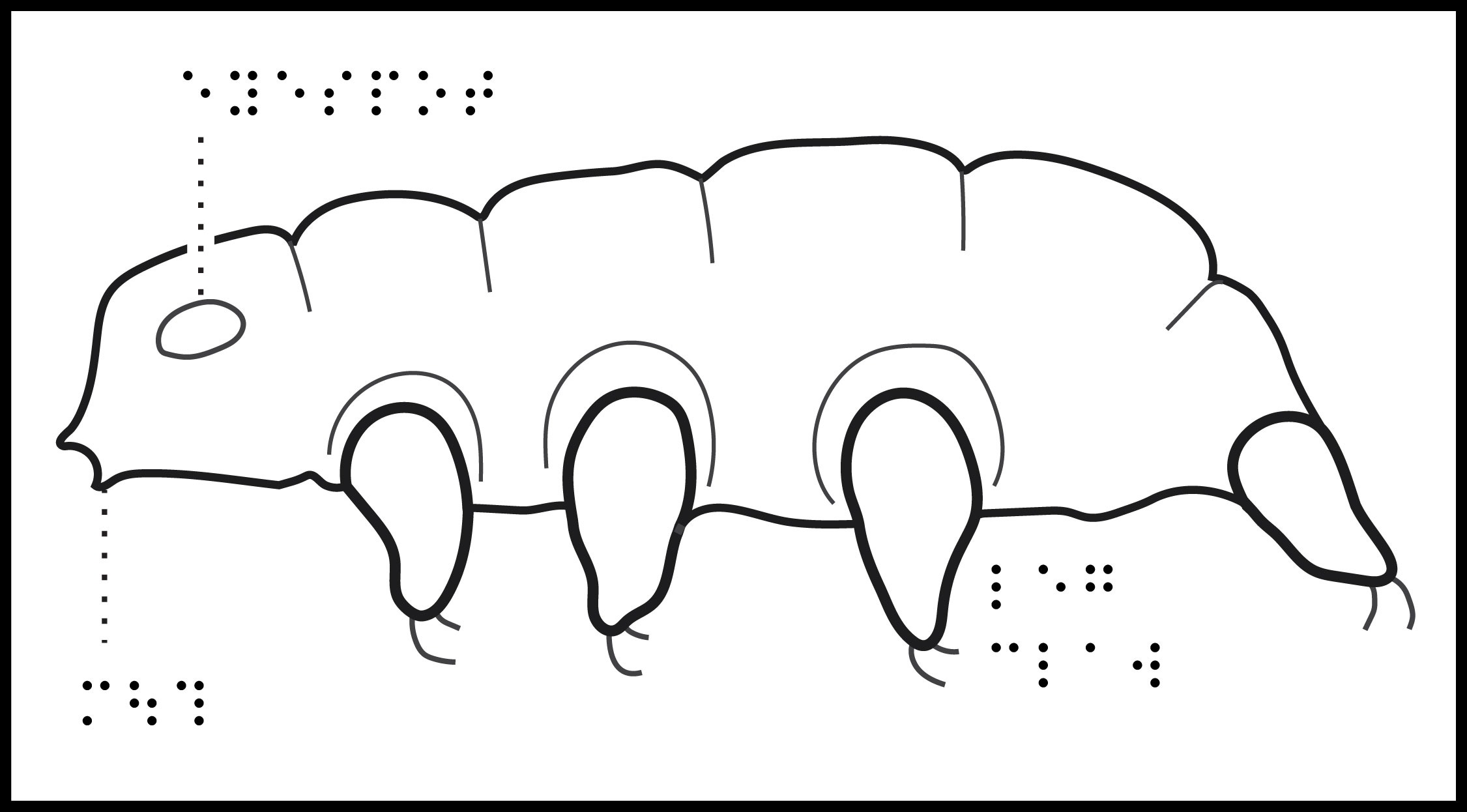
Title: Tardigrade (Water Bear)
Image Description: Illustration of a tardigrade from three angles, including the side view in the top half of the page and front facing and the underside...
https://lighthouse-sf.org/wp-content/uploads/2021/10/Tardigrade_featured.jpg12462251Naomi Rosenberghttps://lighthouse-sf.org/wp-content/uploads/2025/01/lighthouse-sf-logo.svgNaomi Rosenberg2021-10-22 12:00:562021-10-22 12:00:56What does a tardigrade look like?
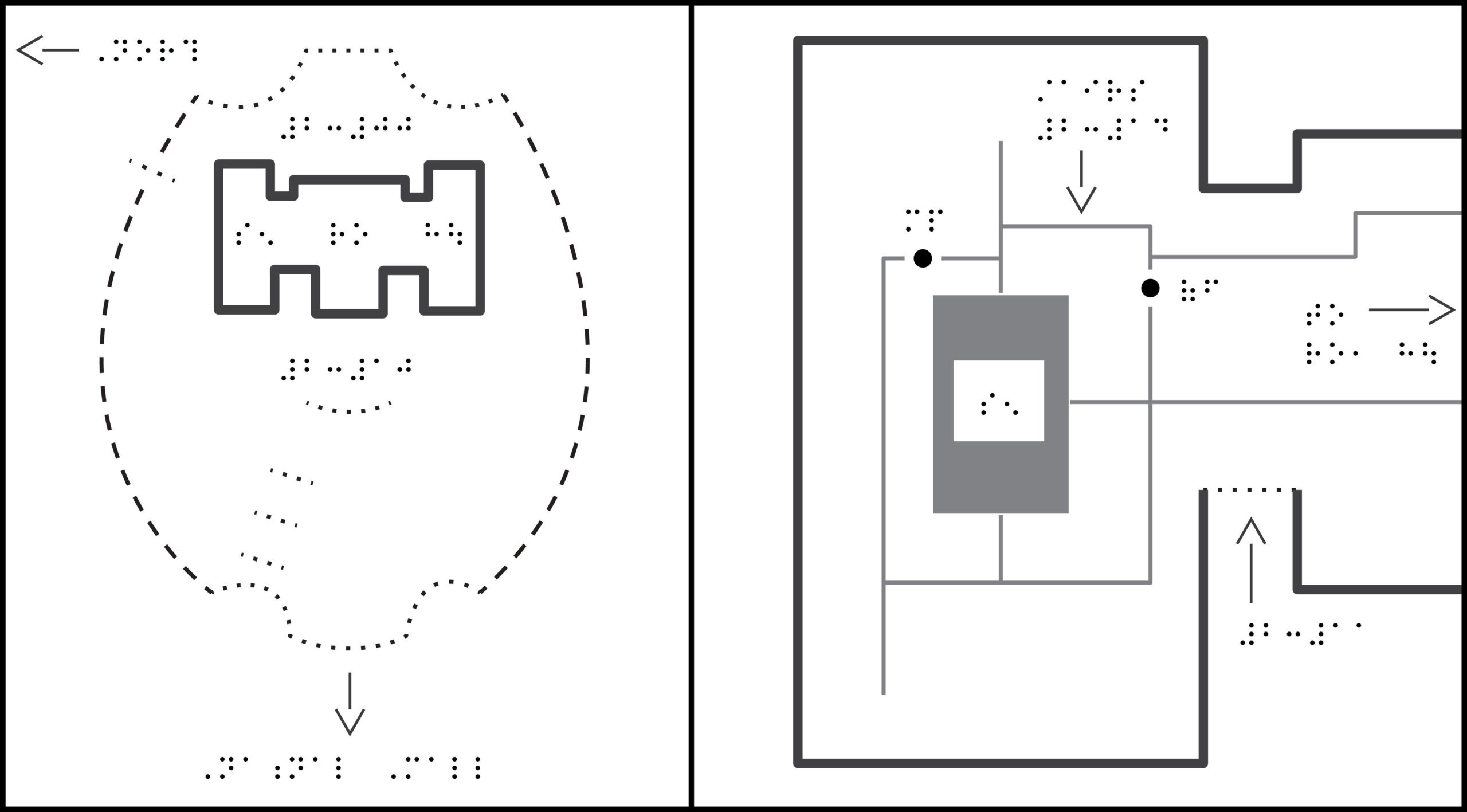
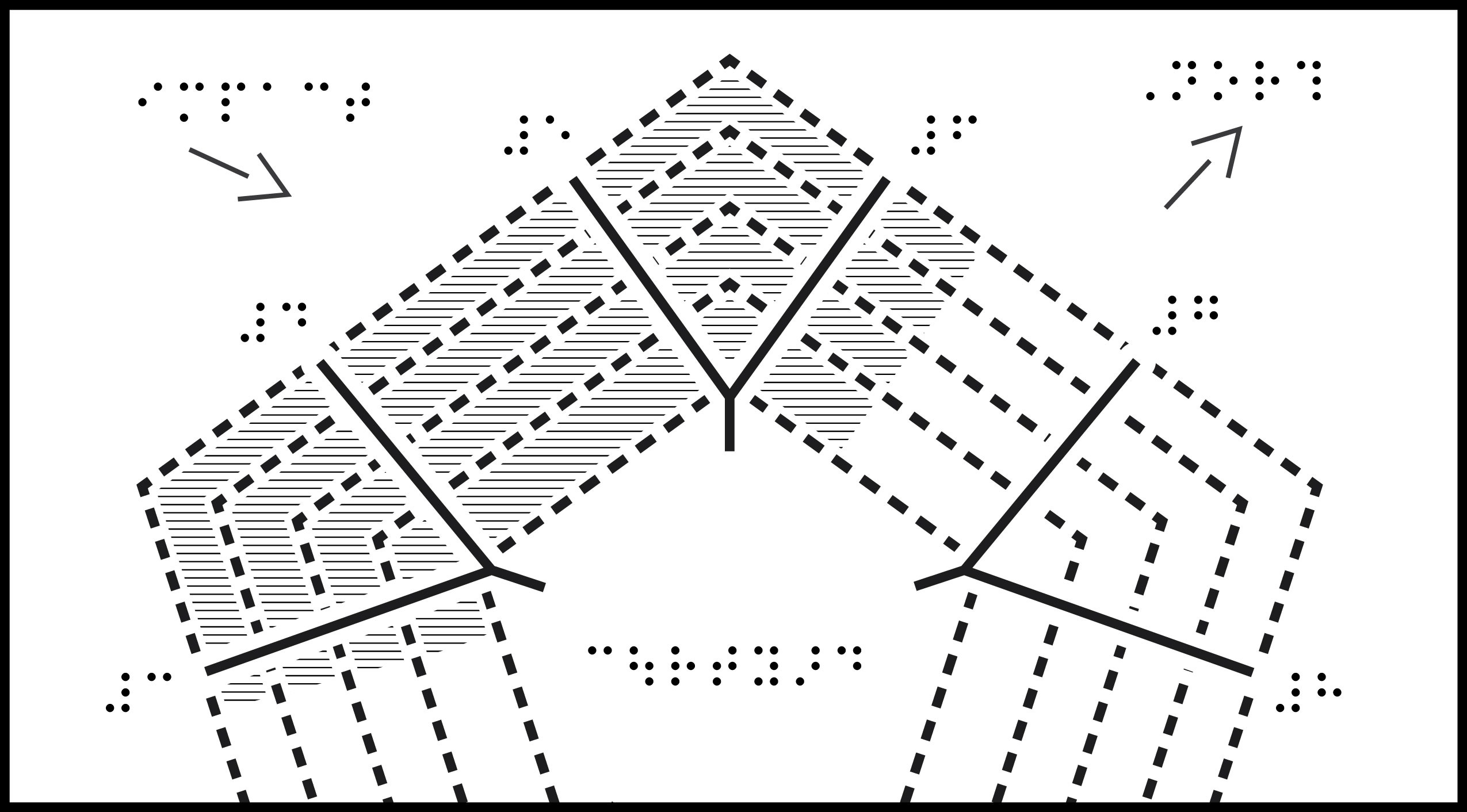
Title: Pentagon 9/11 Layout
Note: For this week you chose the location of the different branches of the military in the Pentagon. We found it very difficult to find a verifiable...
https://lighthouse-sf.org/wp-content/uploads/2021/10/PentagonLayout_featured.jpg14122550Naomi Rosenberghttps://lighthouse-sf.org/wp-content/uploads/2025/01/lighthouse-sf-logo.svgNaomi Rosenberg2021-10-08 12:00:392021-10-08 12:00:39Touching The News: Where was the Pentagon hit on 9/11?