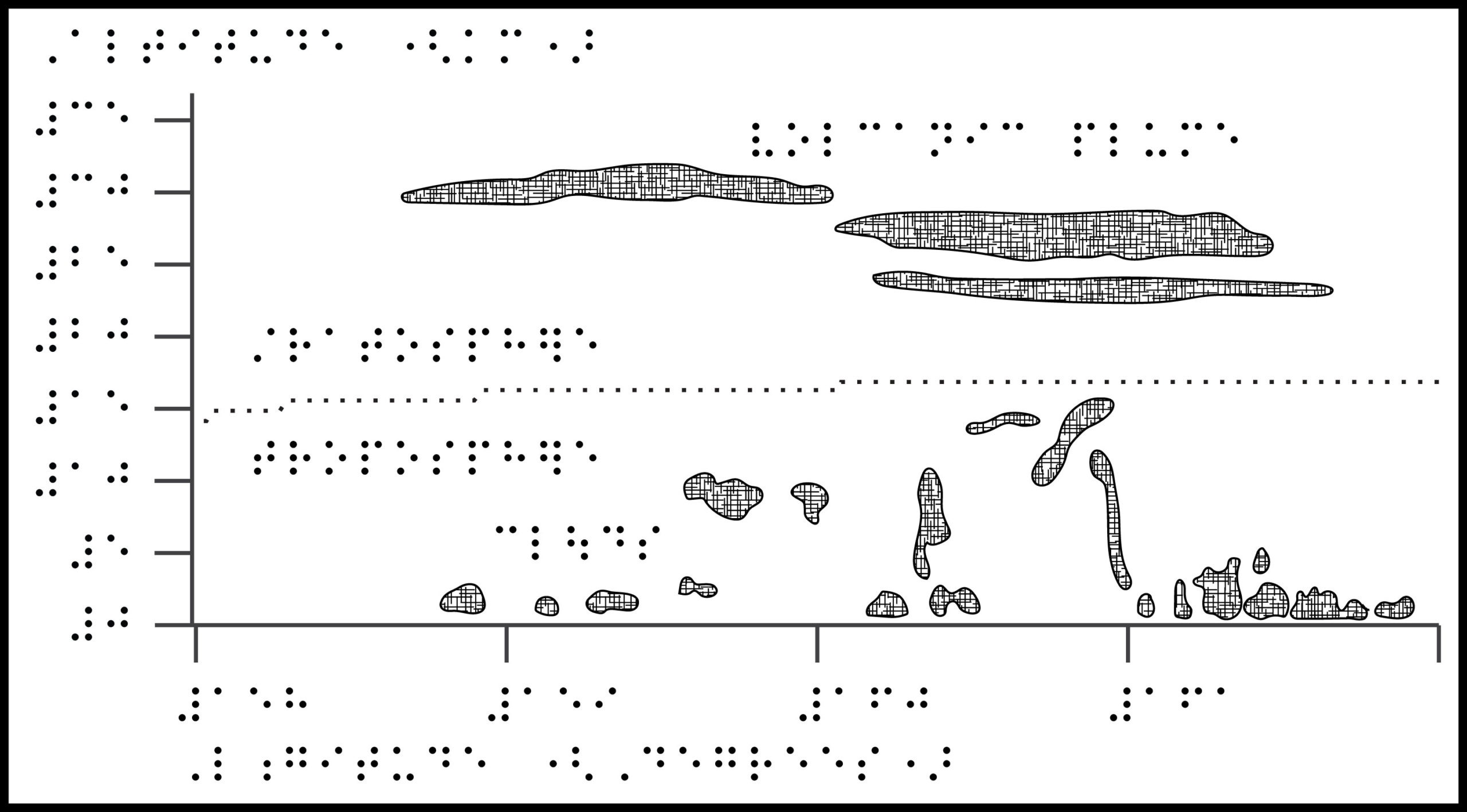
Title: Tonga volcanic plume height
Image Description: Chart showing a 2-dimensional view of the stratosphere and troposphere. The y-axis shows Altitude, from 0 to 35 km. The x-axis shows Longitude, from 158 to 162 degrees. There is a horizontal line at 15 kilometers separating the troposphere on the bottom with small, scattered clouds and the stratosphere on top with long, thin volcanic plumes.
ZIP folder contains files for producing tactile graphics on 8.5 x 11-inch paper, landscape:
- PRNs for ViewPlus Columbia / Delta, APH PixBlaster, IRIE BrailleTrac / BrailleSheet;
- PDFs for Swell, Microcapsule or PIAF;
- Reference PDFs with corresponding large print text (not for tactile production).
Printing Instructions and Supported Embossers
How to unzip/uncompress: Windows 10, Windows 8.1, MacOS.
Source:Hunga Tonga-Hunga Ha‘apai Erupts, NASA Earth Observatory; Tonga volcano: Plume reached half-way to space, BBC News.
Submit Your Ideas and Touch The News
Sign up
Sign up to receive tactile graphics files to print at home.