Infographic Text and Description:
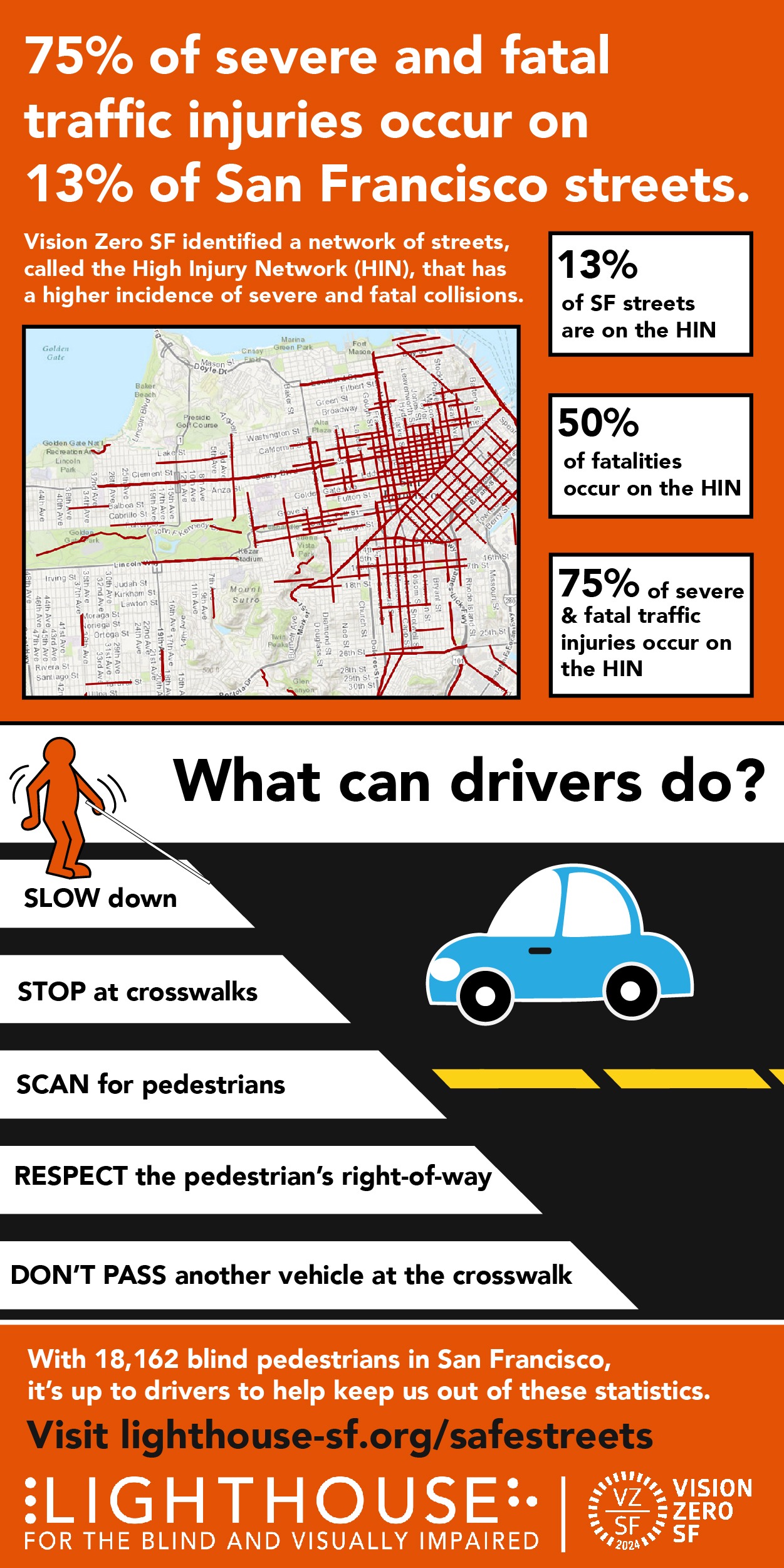
75% of severe and fatal traffic injuries occur on 13% of San Francisco streets.
Vision Zero SF identified a network of streets, called the High Injury Network (HIN), that has a higher incidence of severe and fatal collisions.
Graphic: A map of San Francisco shows red lines that indicate the HIN clustered around Downtown San Francisco as well as scattered corridors in Golden Gate Park, along Geary in the Richmond and in North Beach.
Pop out boxes read:
- 13% of SF streets are on the HIN
- 50% of fatalities occur on the HIN
- 75% of severe & fatal traffic injuries occur on the HIN
What can drivers do?
Graphic Description: A Keith Haring-style figure with a white cane enters a cross walk with a car stopped at a safe distance waiting for the pedestrian to cross. Tips for drivers are in black text over the white lines of the crosswalk:
SLOW down
STOP at crosswalks
SCAN for pedestrians
RESPECT the pedestrian’s right-of-way
DON’T PASS another vehicle at the crosswalk
With 18,162 blind pedestrians in San Francisco, it’s up to drivers to help keep us out of these statistics.
Visit lighthouse-sf.org/safestreets.
LightHouse Logo
Vision Zero SF Logo