
Title: Ukraine Map
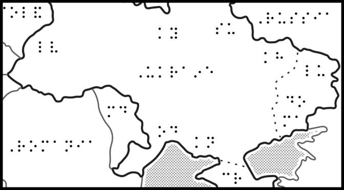
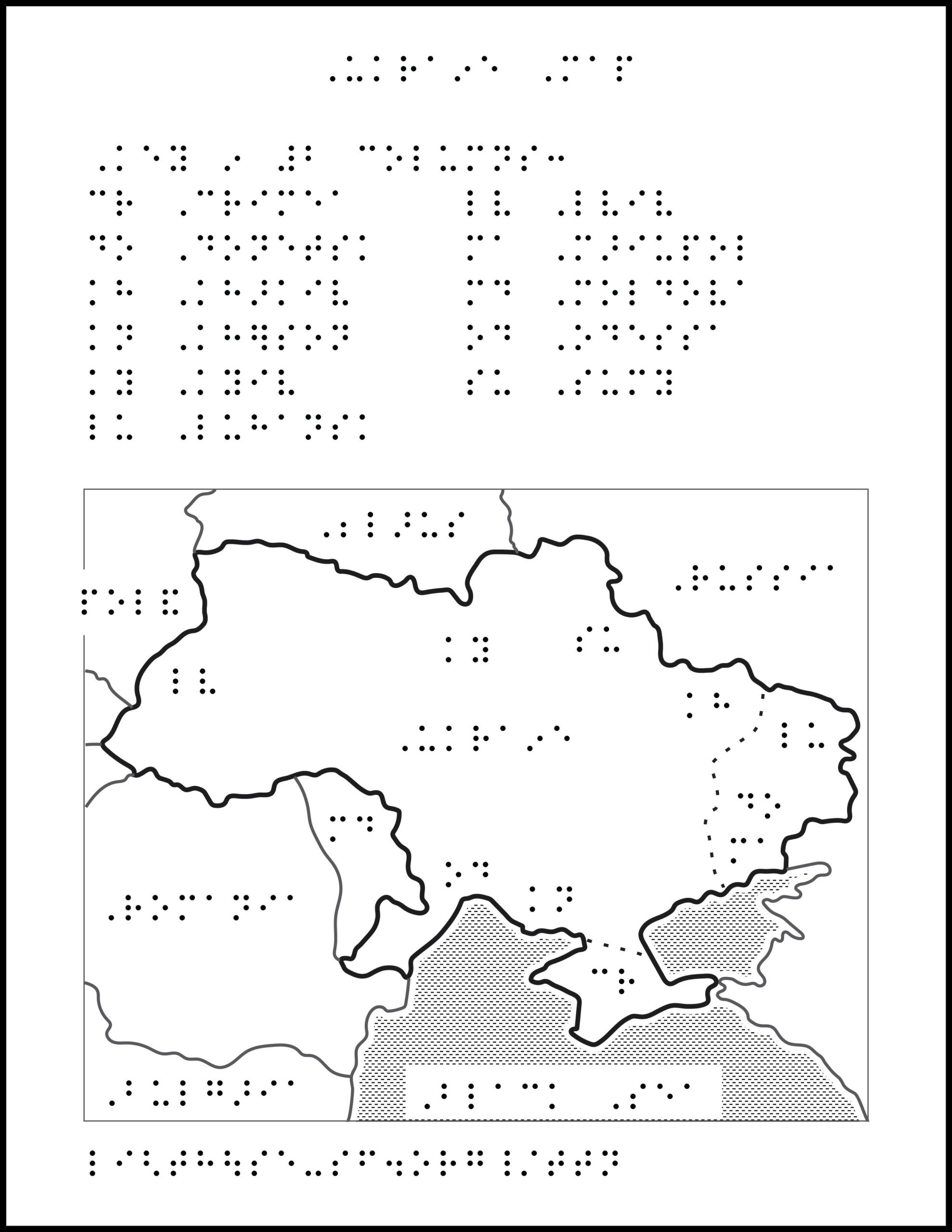
Image Description: Map of Ukraine with bordering countries and prominent cities labeled. North is up; north arrow is omitted. Surrounding Ukraine, clockwise from the northeast, is Poland, Belarus, Russia (northeast and east), Black Sea, Moldova, Romania, Hungary (not labeled), Slovakia (not labeled). Crimea is south of Ukraine within the Black Sea, though land adjacent. Cities are labeled with abbreviations, clockwise from the northeast border with Poland: Lviv, Kyiv, Sumy, Kharkiv, Luhansk, Donetsk, Mariupol, Kherson, Odessa. Crimea (south) and the Donbas region (east), are separated with a dotted line.
ZIP folder contains files for producing tactile graphics on 8.5 x 11-inch paper, portrait:
- PRN for ViewPlus Columbia / Delta, APH PixBlaster, IRIE BrailleTrac / BrailleSheet;
- PDFs for Swell, Microcapsule or PIAF;
- Reference PDFs with corresponding large print text (not for tactile production).
Printing Instructions and Supported Embossers
How to unzip/uncompress: Windows 10, Windows 8.1, MacOS.
Source: Mapping the Russian invasion of Ukraine, Washington Post.
Submit Your Ideas and Touch The News
Sign up
Sign up to receive tactile graphics files to print at home.