
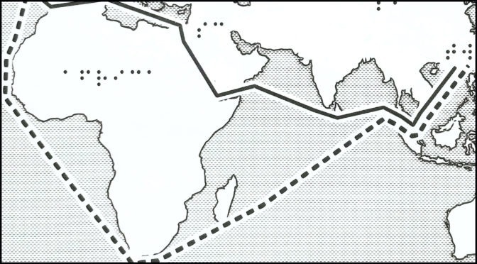
Tactile map 1: Alternative route for shipping while Suez Canal blocked
Description: Tactile map of shipping route using Suez Canal and route around Cape of Good Hope. Routes connect Rotterdam, Netherlands to Kaohsiung, Taiwan. Additional information not on tactile graphic:
- Using Suez Canal: 10,000 nautical miles, 18,520 km, 25.5 days (avg speed)
- Around Cape of Good Hope, 13,500 nautical miles, 25,002 km, 34 days (avg speed)
Source: Suez Canal: Ships stuck in ‘traffic jam’ as salvage efforts continue, BBC.
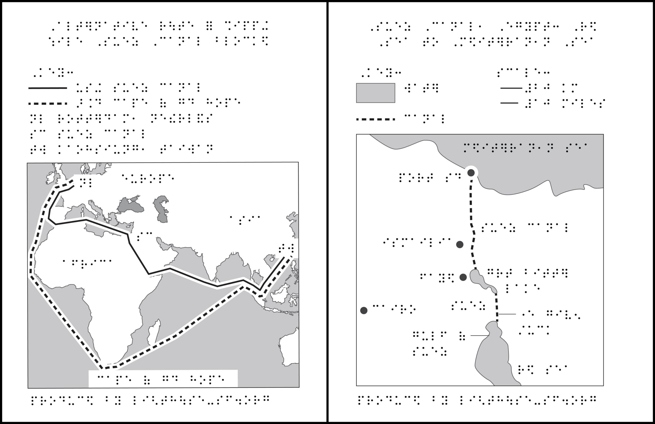
Tactile map 2: Suez Canal, Egypt: Red Sea to Mediterranean Sea
Description: Tactile map of Suez Canal from Red Sea to Mediterranean Sea, showing location where Ever Given hit right bank of canal.
Source: Suez Canal: Owner of cargo ship blocking waterway apologises, BBC.
Related podcast: Tug Life: The story of the small boats helping reopen the Suez Canal.
ZIP folder contains files for producing 2 tactile maps on 8.5 x 11-inch paper:
- PRNs for ViewPlus Columbia / Delta, APH PixBlaster, IRIE BrailleTrac / BrailleSheet;
- PDFs for Swell, Microcapsule or PIAF;
- Reference PDFs with corresponding large print text (not for tactile production).
Printing Instructions and Supported Embossers
How to unzip/uncompress: Windows 10, Windows 8.1, MacOS.
Submit Your Ideas and Touch The News
Sign up
Sign up to receive tactile graphics files to print at home.