- About TMAP: General questions about the TMAP app and the maps it can make. Also see About TMAP page
- Getting TMAPs: Questions about maps from Adaptations and about getting a user account.
- Using TMAP to make your own tactile street maps: Questions about the TMAP app, how it works, bugs, and technical stuff. Also see How to Use TMAP to Make Maps page
- Printing TMAPs: Questions about printing TMAP files. Also see Printing Instructions page
- On the Map: About the actual map, and what’s on it. Also see About TMAP page
- Reading or teaching TMAPs: Questions about what’s on a TMAP, how to read it, and how to use it. Also see Reading Tactile Maps page
1. About TMAP
General questions about the TMAP app and the maps it can make.
What is TMAP?
TMAP is a tool to generate tactile street maps. Tactile Maps Automated Production (TMAP) is a project of LightHouse for the Blind and Visually Impaired and Smith-Kettlewell Eye Research Institute.
How much area does a TMAP cover?
TMAPs can range from a few blocks to a few miles wide, depending on the map scale and paper size. TMAP can generate maps at six different zoom levels, from 1:1500 to 1:50000. For more about map scale, see What is map scale?
Can I get a map of anywhere?
TMAP works best for addresses within North America. It can generate maps of addresses outside North America, but results may vary.
What kind of maps can I get from TMAP?
TMAP makes tactile street maps, ranging from a few blocks to a few miles wide, using raised lines and textures to represent roads, pedestrian paths, railways, and buildings (when the data is available). Maps include braille and large print street labels, north arrow, scale, and key.
Can TMAP make campus maps?
Yes, with a caveat. TMAP can make maps showing streets, service roads, paths, and buildings (when the data is available), which are all essential features on a campus map. TMAP will not label buildings, quads or path names. Most campuses are too large to fit on a TMAP while remaining legible. If you would like a campus map, we recommend that you contact MAD Lab to customize a TMAP to best fit your needs. Or fill out our contact form.
Can TMAP make maps of cities, states, and countries?
No, but our skilled design team can create custom maps. Contact MAD Lab or fill out our contact form. Also check out Adaptations map collection.
Can TMAP make maps of floor plans or building interiors?
No, but our skilled design team can create custom maps. Contact MAD Lab or fill out our contact form.
Are digital TMAP files screen reader accessible?
No. TMAP produces SVG and PDF files that are designed to be embossed. If you would like to collaborate with us to create an accessible digital map, get in touch.
2. Getting TMAPs
Questions about maps from Adaptations and about getting a user account.
How can I get a TMAP?
You can order a map from LightHouse’s Adaptations store or call 1-888-400-8933. Alternately, if you have an embosser or tactile printer, you can create and print your own maps. Sign up here.
What do I get when I order a TMAP from Adaptations?
You will receive an introductory page along with two maps of the same address—one map zoomed-in, with streets, paths, and railways, if data is available, and one zoomed-out with streets only. Please specify special requests to the product specialists at the Adaptations Store when ordering your TMAP.
Can I print my own maps?
Yes. If you have an embosser or tactile printer, you can create and print your own maps. Sign up for a TMAP user account. TMAP produces SVG and PDF files suitable for printing on ViewPlus embossers, PixBlaster, and Swell/capsule paper. See Printing Instructions for more information.
Can you add features to my TMAP?
Yes. TMAPs show streets and labels for streets that meet the edge of the map, paths, railways, and a locator dot on the map’s address. If you would like additional labels, buildings, or multiple points of interest, our skilled design team can customize your TMAP. Email us or fill out our contact form.
3. Using TMAP to make your own tactile street maps
Questions about the TMAP app, how it works, bugs, and technical stuff.
How does TMAP work?
TMAP uses Google Maps to search for an address, intersection or landmark. TMAP uses the resulting coordinates to pull data from OpenStreetMap, creating separate SVG files for each: tactile map page, print map page, tactile key page(s), and map key page(s). When you download a map file, TMAP combines the SVG files into a PDF optimized for 2-in-1 emboss on a ViewPlus printer. Also see How to Use TMAP to Make Maps and Printing Instructions.
Which browsers are compatible with the TMAP app?
We recommend using Chrome, Firefox, or Safari.
What does Map Scale mean?
See What is map scale.
TMAP error: “We’re sorry, it looks like there are no results for that address or location.”
This happens when Google cannot find the address you are searching. A few things to try: check spelling; omit apartment numbers; use either city or zip code, not both. Try your search in Google maps. If it gives you a “partial match,” then try a different address. If it finds your searched address, please contact us.
TMAP error: “Sorry, there was an error.”
Please contact us, specifying the address, as well as setting for paper size and scale. This can happen when a street label contains an uncommon character. We will try to address the issue as soon as possible.
Is this a bug?
Despite our best efforts, there might be bugs. If you think you’ve encountered a TMAP bug, please contact us. Sometimes what appears to be a bug was an intentional design decision. We will attempt to respond to all questions and feedback but cannot offer technical support at this time.
4. Printing TMAPs
Questions about printing TMAP files.
Which embossers or printers can print TMAP files?
TMAP is designed for ViewPlus embossers with 2-in-1 printing capabilities but can also be printed on tactile-only ViewPlus embossers (like VP Columbia or VP Delta), on APH PixBlaster, or on capsule paper (Swell, Zychem, PIAF). Since the braille font is intended for ViewPlus embossers, braille on capsule paper may be low. See Printing Instructions.
TMAPs can also be embossed on Index (using TactileView / TactileView-US), though at a lower resolution than ViewPlus.
Since MAD Lab does not have Juliet or Romeo embossers in our shop, we have not tested their TMAP printing capabilities. Please email us to let us know if you have success printing to these embossers, and we will happily share your tips.
The braille seems off, either too big, too small, too squished, or too low.
If embossing on ViewPlus, check that you ran the TMAP PDF through PDF Unembed Fonts, and that you printed from the file with _VP at the end. Disclaimer: this does not always solve the issue. See Printing Instructions page.
If printing on Swell or capsule paper, check that you printed the file at 100% scale or actual size, not ‘shrink to fit’ or ‘fit to page’. The braille font on TMAPs is intended for ViewPlus embossing, and is slightly smaller than Swell-Braille font, so it might be lower than desired. Braille near the edge of the page may not swell as high, and not all Swell/capsule paper is created equal.
5. On the Map
About the actual map, and what’s on it.
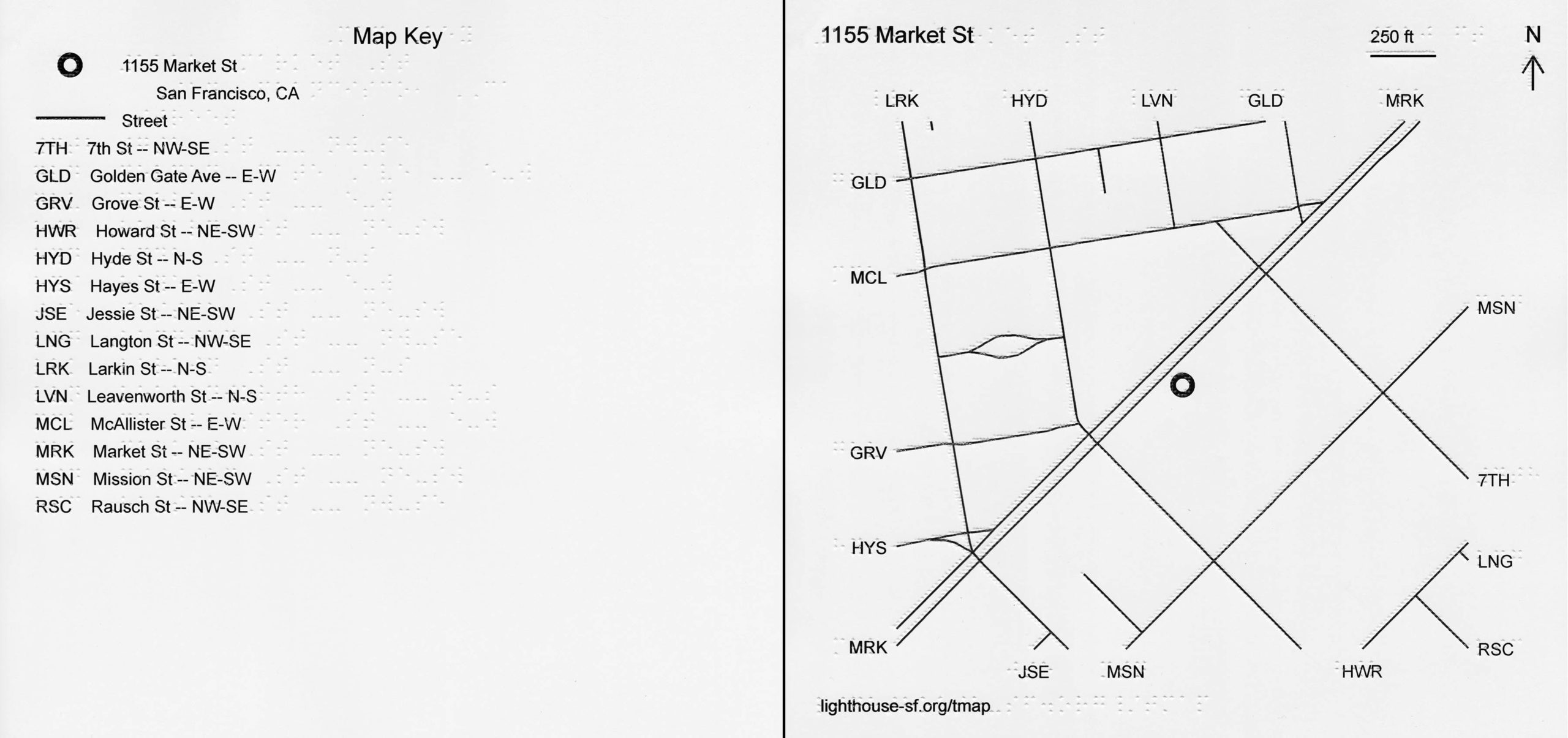
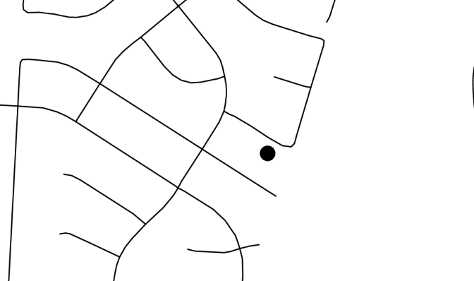
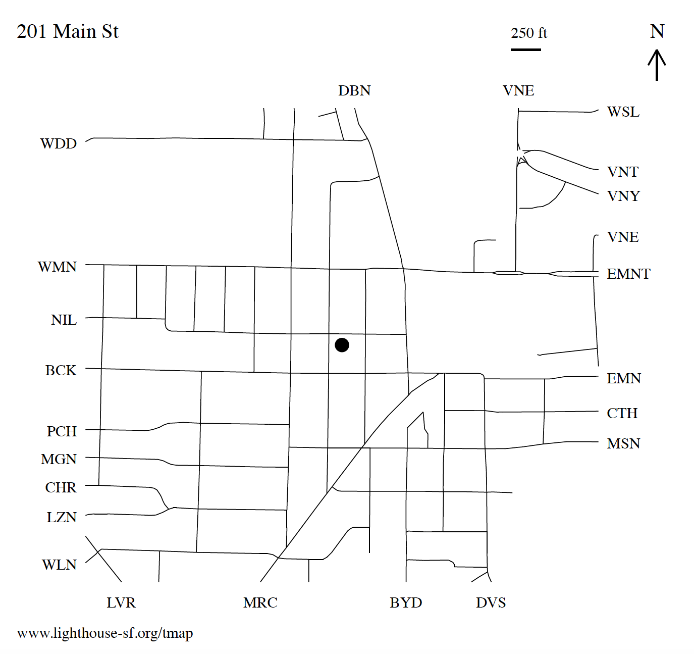
What is on a TMAP?
TMAPs are titled with an address, marked on the map with a locator dot. Each map has a north arrow, as well as a scale line and the equivalent real-world distance. By default, maps contain streets and labels for streets that reach the edge of the map. Maps can also show paths and railways (and buildings upon request), when the data is available. Each map comes with a corresponding key. Map files contain both braille and print text. Maps purchased from Adaptations are embossed and printed with ink, containing both tactile and visual information. Download Introduction to TMAP page.
What material is the map?
TMAPs produced by the MAD Lab are embossed and printed onto heavy cardstock (paper) using a ViewPlus EmFuse 2-in-1 printer, combining tactile and ink-print onto a single page. Both map and key pages contain braille and large print text, tactile and ink graphics.
Can I get my map in Grade 2 Braille?
No. The braille on the map and key is uncontracted (Grade 1), Unified English Braille (UEB). We hope to add a contracted braille option in the future.
Why aren’t all the streets labeled?
Our automated mapping system uses an algorithm to determine which streets are labeled and how. Only streets that meet the edge of the map are labeled to prevent clutter. A street may not be labeled due to space constraints, lack of street name or lack of data from OpenStreetMap (where TMAP data originates).
Why is there no title on my map?
This may be a bug in our software or an error with the address used to make your map. This can occur on maps outside North America, or for maps of a park or open space without a defined address. If ordered from Adaptations, please contact us to determine if there was an error in the production of your map. If generating your own map, also see How to Use TMAP to Make Maps.
What is map scale?
Map scale is the relationship between distances on a map and the world it represents. We represent map scale as a ratio, with the first number (1 in our case) as 1 unit on the printed map, and the second number (1500, 2500, … 50000) as the number of units it represents in the real world. The default TMAP scale is 1:5000, which means 1 inch on the map represents 5000 inches in the real world. Since we’re talking about units, it could also be 1 foot on the map represents 5000 feet in the real world.
Examples of what each scale might show in an urban area on 11.5 x 11-inch paper:
- 1:1500 – intersection
- 1:2500 – 1-4 block area
- 1:5000 – 8-12 block area
- 1:12500 – neighborhood, 6-8 blocks wide
- 1:25000 (not recommended for urban areas due to density) – college campus overview
- 1:50000 (not recommended for urban areas due to density) – part of regional park
For detailed information about available scales, see the table below:
| Scale | Scale line length on map (feet) | 11.5 x 11 map width (miles) | 8.5 x 11 map width (miles) | 17 x 11 map width (miles) |
|---|---|---|---|---|
| 1:1500 | 50 | 0.07 | 0.04 | 0.12 |
| 1:2500 | 100 | 0.14 | 0.09 | 0.23 |
| 1:5000 (default) | 250 | 0.28 | 0.18 | 0.47 |
| 1:12500 | 500 | 0.56 | 0.36 | 0.93 |
| 1:25000 | 1000 | 1.12 | 0.72 | 1.87 |
| 1:50000 | 2500 | 2.25 | 1.44 | 3.73 |
6. Reading or teaching TMAPs
Questions about what’s on a TMAP, how to read it, and how to use it.
Can you modify a TMAP, add labels, remove unnecessary streets, make lines bolder?
Yes. TMAPs show streets and labels for streets that meet the edge of the map, paths, railways, and a locator dot on the map’s address. If you would like additional labels, buildings, or multiple points of interest, our skilled design team can customize your TMAP. Email us or fill out our contact form.
How can I customize TMAPs myself?
We recommend customizing maps to meet your or your student’s needs, either using a collage method, or digitally. You can open or import SVG or PDF files into a variety of design programs (Adobe Illustrator, Adobe Reader, Inkscape, TactileView), and add or omit elements. Be sure not to resize the map, as the braille will not print correctly. TMAP uses Braille29 font, 29pt font size.
Can TMAP be used to teach routes through distance learning?
Yes. Teachers and O&M instructors use TMAPs to pre-teach routes around students’ neighborhoods or routes near their schools or workplaces. Also see Reading Tactile Maps and Putting the Mobile in Mobility.
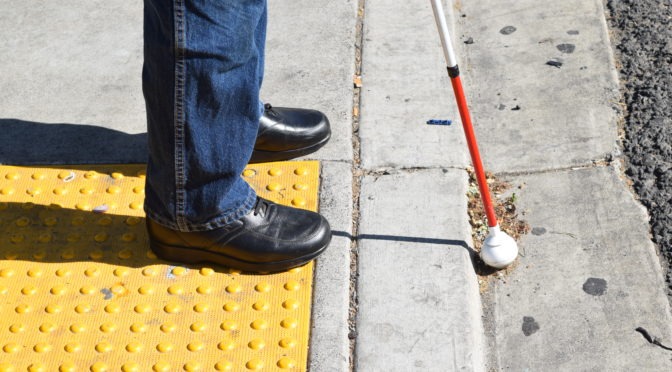
Do you have any materials to build tactile reading skills in preparation for reading TMAPs?
Tactile Intersection Diagrams are for sale at the Adaptations store. You can also download mazes and print them yourself on capsule paper.