
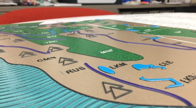
Photo: A close up shows the raised tactile features and brights blues and greens of this accessible map of California.
In the era of Google, reading a map can be deceptively simple. The 664 miles from say, Redding to San Diego, can seem like a simple calculation of hours, minutes, or transit stops – but truly understanding a place’s geography is not so straightforward. That’s why our state’s most reputable sources for accessible education tapped LightHouse to create a map worthy of the institution: encompassing the mountains, rivers, desert expanses and the varied, beautiful patterns of California.
Maps give us the bigger picture, show us how the earth unfolds and inform us how to traverse it – all opportunities blind people crave equally with their sighted peers. Unfortunately, most maps are not accessible. But after months of work, LightHouse’s MAD Lab is proud to present a three-foot large print, braille and tactile map of the entire state of California. It is their biggest tactile map yet.
Commissioned by the State Braille and Talking Book Library in Sacramento, the map will be part of a temporary display at the California State Capitol Building in January. It will later be moved to its permanent home at the Braille and Talking Book Library in Sacramento.
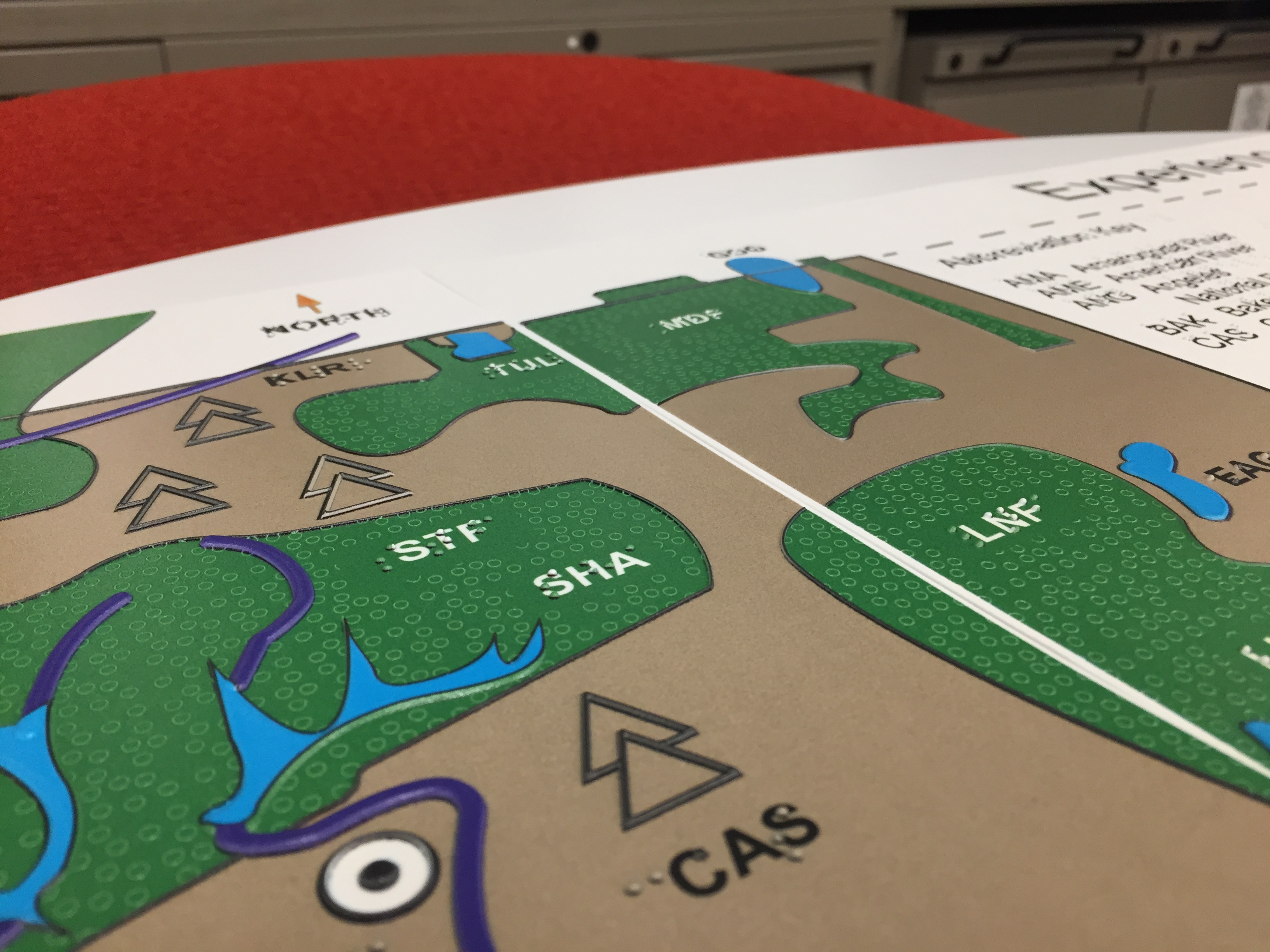
The map is 40 inches tall and 34 inches wide and was printed in six individual sections that make up the completed map. It was printed on the LightHouse’s new UV flatbed printer. High contrast coloration and large print facilitate viewing for people with low vision, and a selection of tactile symbols and fill textures denote cities, rivers, lakes, mountains, forests and deserts.
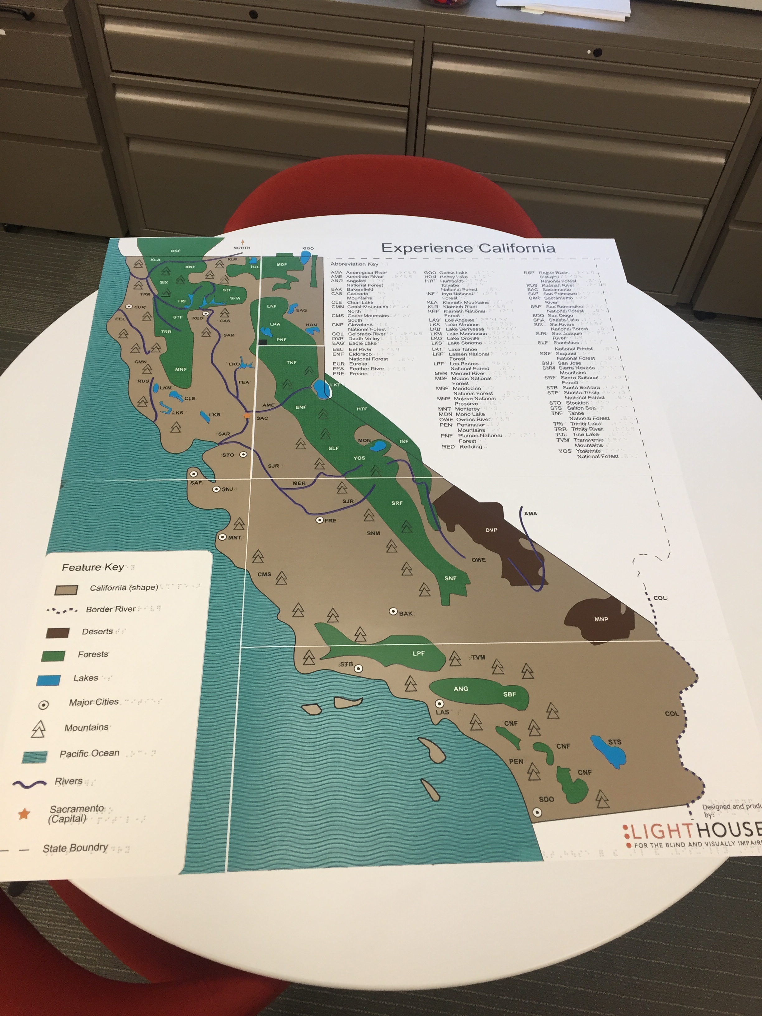
The state map went through many iterations in the design process, partially because the MAD Lab designers were met with the challenge of creating background fill textures for lakes and forests that, when touched, didn’t compete with symbols for specific landmarks.
“We had to figure out how to create varied textures, so you can tell there are different features, but also fade into the background enough so mountains and rivers could be felt on top as distinct landforms,” says Designer and Accessible Media Specialist Julie Sadlier.
By scaling down the size of the texture, Julie says they were able to achieve this. The first full draft of the map was printed in early December. The LightHouse’st Frank Welte was the first blind person to see the map after it was assembled.
“I’m a California Native, so I’ve seen some tactile maps of the state before but this one was probably the biggest tactile map of California I’ve ever seen,” says Frank. “It was fun to explore parts of California with which I’m not familiar, like the Northeastern part.”
And though exploring California is a perk, the overarching goal of the display is to raise awareness about the work of the Braille and Talking Book Library and its role in braille literacy and services for the blind and low vision community.
“One of the hardest things in the network of libraries serving the blind is getting the word out about our work,” says Director of the library Mike Marlin. “We provide a free service, so this display is a really helpful outreach tool. It gets our work in front of legislators and the public.”
Frank too, hopes the map encourages more institutions and organizations to make tactile maps and other material available to their communities.
“I think it is wonderful for tactile graphics to be given high visibility, so that the general public can appreciate their value as we in the blind community already do,” he says.
MAD Lab is an important resource in collaborating with organizations to make these kinds of accessible tactile tools available. The MAD Lab has earned a reputation for producing fabulous tactile media of all kinds, including raised line drawings, tactile graphics and tactile maps like this one for Alcatraz, and other GGRNA maps – for everything from Burning Man to BART.
For a rate sheet or an informal quote on a business project, contact MADLab@lighthouse-sf.org or call 415-694-7349.